You are here: Home > Network List > AV - Alaska Volcano Observatory Stations List
> Station MAPS Pakushin Southeast, Makushin Volcano, Alaska > Earthquake Result Viewer
MAPS Pakushin Southeast, Makushin Volcano, Alaska - Earthquake Result Viewer

| Earthquake location: |
Northern Molucca Sea |
| Earthquake latitude/longitude: |
1.3/126.3 |
| Earthquake time(UTC): |
2016/06/07 (159) 19:15:15 GMT |
| Earthquake Depth: |
31 km |
| Earthquake Magnitude: |
6.3 MWW, 6.2 MWB, 6.3 MWC, 6.4 MWC, 6.5 MI, 6.6 MI |
| Earthquake Catalog/Contributor: |
NEIC PDE/NEIC COMCAT |
|
| Network: |
AV Alaska Volcano Observatory |
| Station: |
MAPS Pakushin Southeast, Makushin Volcano, Alaska |
| Lat/Lon: |
53.81 N/166.94 W |
| Elevation: |
333 m |
|
| Distance: |
75.4 deg |
| Az: |
34.269 deg |
| Baz: |
251.654 deg |
| Ray Param: |
0.051674087 |
| Estimated Moho Depth: |
27.0 km |
| Estimated Crust Vp/Vs: |
1.86 |
| Assumed Crust Vp: |
3.943 km/s |
| Estimated Crust Vs: |
2.117 km/s |
| Estimated Crust Poisson's Ratio: |
0.30 |
|
| Radial Match: |
87.76106 % |
| Radial Bump: |
400 |
| Transverse Match: |
88.17042 % |
| Transverse Bump: |
400 |
| SOD ConfigId: |
7422571 |
| Insert Time: |
2019-04-22 19:12:39.985 +0000 |
| GWidth: |
2.5 |
| Max Bumps: |
400 |
| Tol: |
0.001 |
|
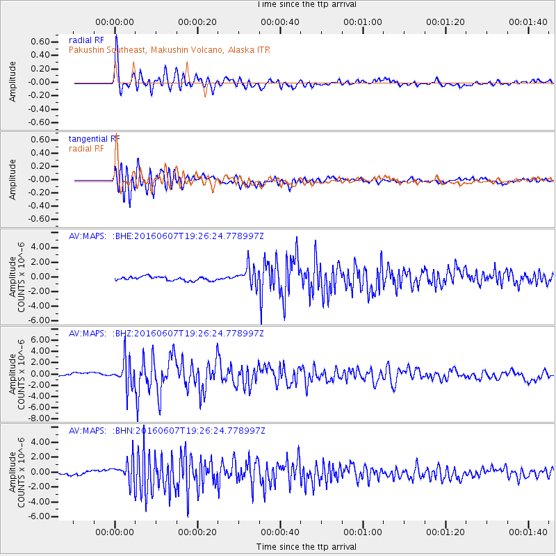
Signal To Noise
| Channel | StoN | STA | LTA |
| AV:MAPS: :BHZ:20160607T19:26:24.778997Z | 7.5857964 | 2.4766437E-6 | 3.2648433E-7 |
| AV:MAPS: :BHN:20160607T19:26:24.778997Z | 6.8768487 | 1.5656411E-6 | 2.276684E-7 |
| AV:MAPS: :BHE:20160607T19:26:24.778997Z | 5.005083 | 1.306038E-6 | 2.6094233E-7 |
| Arrivals |
| Ps | 6.0 SECOND |
| PpPs | 19 SECOND |
| PsPs/PpSs | 25 SECOND |


