You are here: Home > Network List > TA - USArray Transportable Network (new EarthScope stations) Stations List
> Station X43A Marvell, AR, USA > Earthquake Result Viewer
X43A Marvell, AR, USA - Earthquake Result Viewer
*The percent match for this event was below the threshold and hence no stack was calculated.
| Earthquake location: |
Off Coast Of Ecuador |
| Earthquake latitude/longitude: |
1.1/-85.2 |
| Earthquake time(UTC): |
2015/08/07 (219) 12:18:48 GMT |
| Earthquake Depth: |
10 km |
| Earthquake Magnitude: |
5.6 MWW, 5.6 MWC, 5.6 MWB |
| Earthquake Catalog/Contributor: |
NEIC PDE/NEIC COMCAT |
|
| Network: |
TA USArray Transportable Network (new EarthScope stations) |
| Station: |
X43A Marvell, AR, USA |
| Lat/Lon: |
34.52 N/90.88 W |
| Elevation: |
53 m |
|
| Distance: |
33.7 deg |
| Az: |
351.484 deg |
| Baz: |
169.67 deg |
| Ray Param: |
$rayparam |
*The percent match for this event was below the threshold and hence was not used in the summary stack. |
|
| Radial Match: |
41.660805 % |
| Radial Bump: |
303 |
| Transverse Match: |
43.167095 % |
| Transverse Bump: |
310 |
| SOD ConfigId: |
1156111 |
| Insert Time: |
2015-09-17 14:41:42.424 +0000 |
| GWidth: |
2.5 |
| Max Bumps: |
400 |
| Tol: |
0.001 |
|
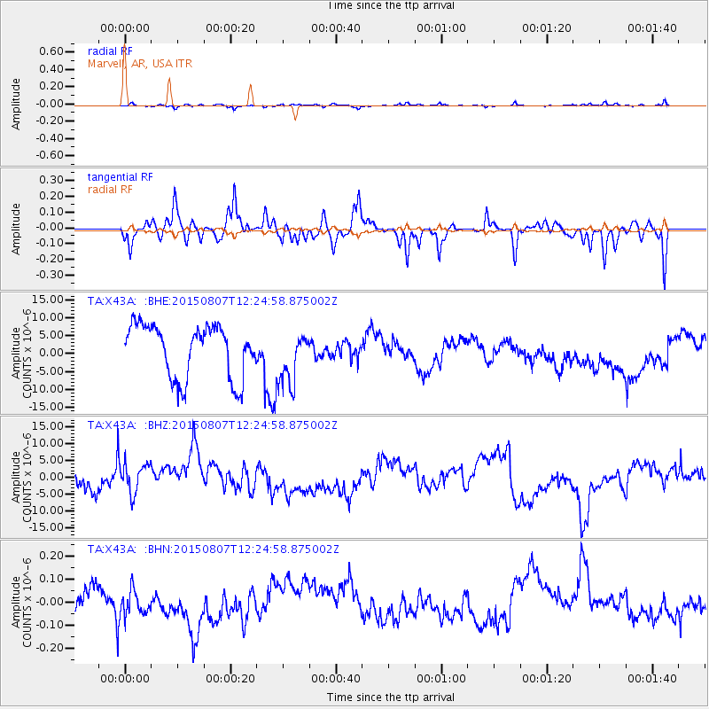
Signal To Noise
| Channel | StoN | STA | LTA |
| TA:X43A: :BHZ:20150807T12:24:58.875002Z | 1.2728609 | 4.8768525E-6 | 3.8314106E-6 |
| TA:X43A: :BHN:20150807T12:24:58.875002Z | 1.0643839 | 6.3487164E-8 | 5.9646865E-8 |
| TA:X43A: :BHE:20150807T12:24:58.875002Z | 1.0004634 | 7.3097463E-6 | 7.3063607E-6 |
| Arrivals |
| Ps | |
| PpPs | |
| PsPs/PpSs | |


