You are here: Home > Network List > US - United States National Seismic Network Stations List
> Station WVOR Wild Horse Valley, Oregon, USA > Earthquake Result Viewer
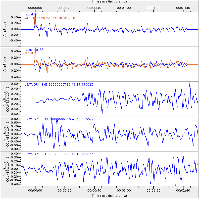
WVOR Wild Horse Valley, Oregon, USA - Earthquake Result Viewer
*The percent match for this event was below the threshold and hence no stack was calculated.
| Earthquake location: |
Northern Mid-Atlantic Ridge |
| Earthquake latitude/longitude: |
23.9/-46.1 |
| Earthquake time(UTC): |
2009/06/06 (157) 20:33:28 GMT |
| Earthquake Depth: |
14 km |
| Earthquake Magnitude: |
6.0 MB, 5.7 MS, 6.0 MW, 6.0 MW |
| Earthquake Catalog/Contributor: |
WHDF/NEIC |
|
| Network: |
US United States National Seismic Network |
| Station: |
WVOR Wild Horse Valley, Oregon, USA |
| Lat/Lon: |
42.43 N/118.64 W |
| Elevation: |
1344 m |
|
| Distance: |
61.7 deg |
| Az: |
306.685 deg |
| Baz: |
82.622 deg |
| Ray Param: |
$rayparam |
*The percent match for this event was below the threshold and hence was not used in the summary stack. |
|
| Radial Match: |
74.5089 % |
| Radial Bump: |
400 |
| Transverse Match: |
66.659424 % |
| Transverse Bump: |
400 |
| SOD ConfigId: |
2648 |
| Insert Time: |
2010-03-05 04:27:52.553 +0000 |
| GWidth: |
2.5 |
| Max Bumps: |
400 |
| Tol: |
0.001 |
|
Signal To Noise
| Channel | StoN | STA | LTA |
| US:WVOR: :BHN:20090606T20:43:15.35002Z | 4.0710535 | 2.203756E-7 | 5.413233E-8 |
| US:WVOR: :BHE:20090606T20:43:15.35002Z | 0.9175346 | 6.330155E-8 | 6.8990914E-8 |
| US:WVOR: :BHZ:20090606T20:43:15.35002Z | 2.0677068 | 1.2305792E-7 | 5.9514203E-8 |
| Arrivals |
| Ps | |
| PpPs | |
| PsPs/PpSs | |


