You are here: Home > Network List > UW - Pacific Northwest Regional Seismic Network Stations List
> Station MRBL Marblemount, WA, USA > Earthquake Result Viewer
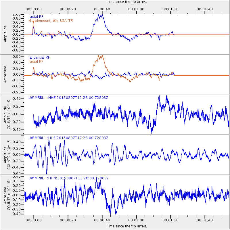
MRBL Marblemount, WA, USA - Earthquake Result Viewer
*The percent match for this event was below the threshold and hence no stack was calculated.
| Earthquake location: |
Off Coast Of Ecuador |
| Earthquake latitude/longitude: |
1.1/-85.2 |
| Earthquake time(UTC): |
2015/08/07 (219) 12:18:48 GMT |
| Earthquake Depth: |
10 km |
| Earthquake Magnitude: |
5.6 MWW, 5.6 MWC, 5.6 MWB |
| Earthquake Catalog/Contributor: |
NEIC PDE/NEIC COMCAT |
|
| Network: |
UW Pacific Northwest Regional Seismic Network |
| Station: |
MRBL Marblemount, WA, USA |
| Lat/Lon: |
48.52 N/121.48 W |
| Elevation: |
75 m |
|
| Distance: |
56.6 deg |
| Az: |
331.878 deg |
| Baz: |
134.862 deg |
| Ray Param: |
$rayparam |
*The percent match for this event was below the threshold and hence was not used in the summary stack. |
|
| Radial Match: |
49.331688 % |
| Radial Bump: |
400 |
| Transverse Match: |
55.324394 % |
| Transverse Bump: |
400 |
| SOD ConfigId: |
1156111 |
| Insert Time: |
2015-09-17 14:47:22.228 +0000 |
| GWidth: |
2.5 |
| Max Bumps: |
400 |
| Tol: |
0.001 |
|
Signal To Noise
| Channel | StoN | STA | LTA |
| UW:MRBL: :HHZ:20150807T12:28:00.72803Z | 4.6221304 | 2.171326E-7 | 4.6976734E-8 |
| UW:MRBL: :HHN:20150807T12:28:00.72803Z | 0.8713754 | 7.643667E-8 | 8.771956E-8 |
| UW:MRBL: :HHE:20150807T12:28:00.72803Z | 0.99554056 | 1.0841152E-7 | 1.0889714E-7 |
| Arrivals |
| Ps | |
| PpPs | |
| PsPs/PpSs | |


