You are here: Home > Network List > TA - USArray Transportable Network (new EarthScope stations) Stations List
> Station R17K Ugashik Creek, AK, USA > Earthquake Result Viewer
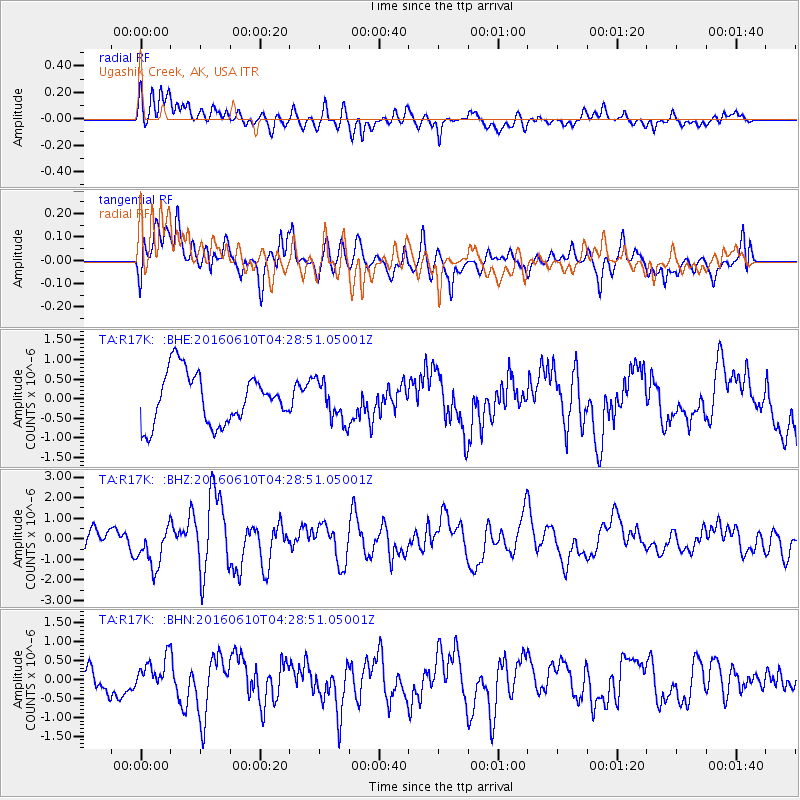
R17K Ugashik Creek, AK, USA - Earthquake Result Viewer
*The percent match for this event was below the threshold and hence no stack was calculated.
| Earthquake location: |
Solomon Islands |
| Earthquake latitude/longitude: |
-8.7/160.5 |
| Earthquake time(UTC): |
2016/06/10 (162) 04:17:44 GMT |
| Earthquake Depth: |
28 km |
| Earthquake Magnitude: |
6.2 MWW |
| Earthquake Catalog/Contributor: |
NEIC PDE/NEIC COMCAT |
|
| Network: |
TA USArray Transportable Network (new EarthScope stations) |
| Station: |
R17K Ugashik Creek, AK, USA |
| Lat/Lon: |
57.64 N/156.39 W |
| Elevation: |
273 m |
|
| Distance: |
74.8 deg |
| Az: |
22.371 deg |
| Baz: |
224.401 deg |
| Ray Param: |
$rayparam |
*The percent match for this event was below the threshold and hence was not used in the summary stack. |
|
| Radial Match: |
63.363613 % |
| Radial Bump: |
400 |
| Transverse Match: |
70.21786 % |
| Transverse Bump: |
400 |
| SOD ConfigId: |
7422571 |
| Insert Time: |
2019-04-22 19:46:48.145 +0000 |
| GWidth: |
2.5 |
| Max Bumps: |
400 |
| Tol: |
0.001 |
|
Signal To Noise
| Channel | StoN | STA | LTA |
| TA:R17K: :BHZ:20160610T04:28:51.05001Z | 2.0010731 | 1.0632727E-6 | 5.313513E-7 |
| TA:R17K: :BHN:20160610T04:28:51.05001Z | 1.2497708 | 4.3067217E-7 | 3.4460095E-7 |
| TA:R17K: :BHE:20160610T04:28:51.05001Z | 0.7845675 | 5.05304E-7 | 6.4405424E-7 |
| Arrivals |
| Ps | |
| PpPs | |
| PsPs/PpSs | |


