You are here: Home > Network List > TJ - Tajikistan National Seismic Network Stations List
> Station GARM Garm, Tajikistan > Earthquake Result Viewer
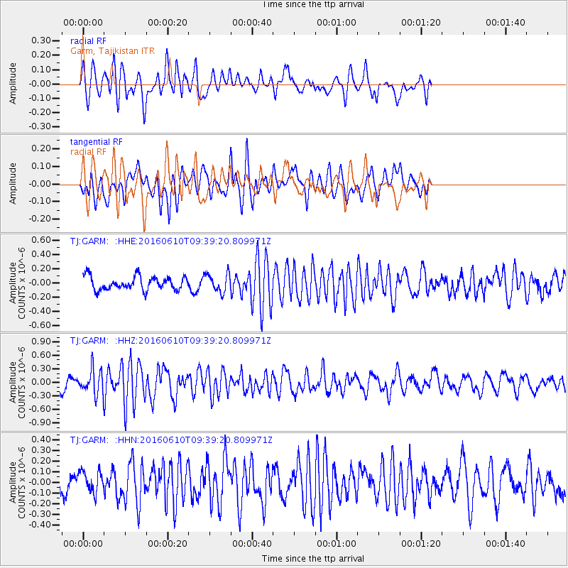
GARM Garm, Tajikistan - Earthquake Result Viewer
*The percent match for this event was below the threshold and hence no stack was calculated.
| Earthquake location: |
Ascension Island Region |
| Earthquake latitude/longitude: |
-7.5/-13.6 |
| Earthquake time(UTC): |
2016/06/10 (162) 09:26:53 GMT |
| Earthquake Depth: |
10 km |
| Earthquake Magnitude: |
5.5 MWP |
| Earthquake Catalog/Contributor: |
NEIC PDE/NEIC COMCAT |
|
| Network: |
TJ Tajikistan National Seismic Network |
| Station: |
GARM Garm, Tajikistan |
| Lat/Lon: |
39.00 N/70.32 E |
| Elevation: |
1305 m |
|
| Distance: |
89.9 deg |
| Az: |
50.786 deg |
| Baz: |
260.412 deg |
| Ray Param: |
$rayparam |
*The percent match for this event was below the threshold and hence was not used in the summary stack. |
|
| Radial Match: |
72.88484 % |
| Radial Bump: |
400 |
| Transverse Match: |
63.838238 % |
| Transverse Bump: |
400 |
| SOD ConfigId: |
7422571 |
| Insert Time: |
2019-04-22 19:56:21.538 +0000 |
| GWidth: |
2.5 |
| Max Bumps: |
400 |
| Tol: |
0.001 |
|
Signal To Noise
| Channel | StoN | STA | LTA |
| TJ:GARM: :HHZ:20160610T09:39:20.809971Z | 2.6061213 | 2.7723652E-7 | 1.06378984E-7 |
| TJ:GARM: :HHN:20160610T09:39:20.809971Z | 1.4828271 | 1.0247242E-7 | 6.9106115E-8 |
| TJ:GARM: :HHE:20160610T09:39:20.809971Z | 1.3876413 | 1.3169002E-7 | 9.4902056E-8 |
| Arrivals |
| Ps | |
| PpPs | |
| PsPs/PpSs | |


