You are here: Home > Network List > AV - Alaska Volcano Observatory Stations List
> Station SPCR Ckakachatna River, Mount Spurr, Alaska > Earthquake Result Viewer
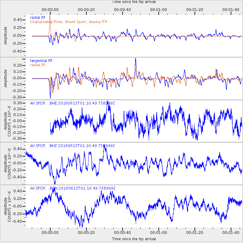
SPCR Ckakachatna River, Mount Spurr, Alaska - Earthquake Result Viewer
*The percent match for this event was below the threshold and hence no stack was calculated.
| Earthquake location: |
Central East Pacific Rise |
| Earthquake latitude/longitude: |
-4.4/-104.8 |
| Earthquake time(UTC): |
2016/06/13 (165) 00:59:39 GMT |
| Earthquake Depth: |
10 km |
| Earthquake Magnitude: |
5.7 MWW, 5.6 MWB, 5.7 MWC |
| Earthquake Catalog/Contributor: |
NEIC PDE/NEIC COMCAT |
|
| Network: |
AV Alaska Volcano Observatory |
| Station: |
SPCR Ckakachatna River, Mount Spurr, Alaska |
| Lat/Lon: |
61.20 N/152.21 W |
| Elevation: |
984 m |
|
| Distance: |
74.9 deg |
| Az: |
338.34 deg |
| Baz: |
130.537 deg |
| Ray Param: |
$rayparam |
*The percent match for this event was below the threshold and hence was not used in the summary stack. |
|
| Radial Match: |
70.03025 % |
| Radial Bump: |
400 |
| Transverse Match: |
73.94099 % |
| Transverse Bump: |
400 |
| SOD ConfigId: |
7422571 |
| Insert Time: |
2019-04-22 20:07:17.926 +0000 |
| GWidth: |
2.5 |
| Max Bumps: |
400 |
| Tol: |
0.001 |
|
Signal To Noise
| Channel | StoN | STA | LTA |
| AV:SPCR: :BHZ:20160613T01:10:49.738999Z | 1.7335058 | 3.8753333E-7 | 2.2355468E-7 |
| AV:SPCR: :BHN:20160613T01:10:49.738999Z | 2.3316712 | 3.6369133E-7 | 1.5597882E-7 |
| AV:SPCR: :BHE:20160613T01:10:49.738999Z | 2.0659926 | 1.761633E-7 | 8.526812E-8 |
| Arrivals |
| Ps | |
| PpPs | |
| PsPs/PpSs | |


