BOZ Bozeman, Montana, USA - Earthquake Result Viewer
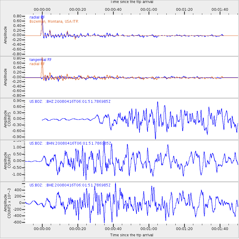
Earthquake location: Andreanof Islands, Aleutian Is.
Earthquake latitude/longitude: 51.9/-179.2
Earthquake time(UTC): 2008/04/16 (107) 05:54:19 GMT
Earthquake Depth: 13 km
Earthquake Magnitude: 6.1 MB, 6.5 MS, 6.6 MW, 6.6 MW
Earthquake Catalog/Contributor: WHDF/NEIC
Network: US United States National Seismic Network
Station: BOZ Bozeman, Montana, USA
Lat/Lon: 45.65 N/111.63 W
Elevation: 1589 m
Distance: 43.5 deg
Az: 70.349 deg
Baz: 303.67 deg
Ray Param: 0.0725058
Estimated Moho Depth: 35.0 km
Estimated Crust Vp/Vs: 1.78
Assumed Crust Vp: 6.35 km/s
Estimated Crust Vs: 3.567 km/s
Estimated Crust Poisson's Ratio: 0.27
Radial Match: 96.14194 %
Radial Bump: 400
Transverse Match: 81.405655 %
Transverse Bump: 400
SOD ConfigId: 2504
Insert Time: 2010-03-05 04:33:05.453 +0000
GWidth: 2.5
Max Bumps: 400
Tol: 0.001

Signal To Noise

ChannelStoNSTALTA
US:BOZ: :BHN:20080416T06:01:51.786985Z4.5346960.227021840.0500633
US:BOZ: :BHE:20080416T06:01:51.786985Z1.43253830.079360410.055398457
US:BOZ: :BHZ:20080416T06:01:51.786985Z5.53719570.145656020.026305018
Arrivals
Ps4.6 SECOND
PpPs14 SECOND
PsPs/PpSs19 SECOND