You are here: Home > Network List > US - United States National Seismic Network Stations List
> Station BOZ Bozeman, Montana, USA > Earthquake Result Viewer
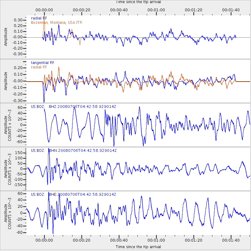
BOZ Bozeman, Montana, USA - Earthquake Result Viewer
*The percent match for this event was below the threshold and hence no stack was calculated.
| Earthquake location: |
South Of Fiji Islands |
| Earthquake latitude/longitude: |
-25.5/-176.4 |
| Earthquake time(UTC): |
2008/07/06 (188) 04:30:26 GMT |
| Earthquake Depth: |
49 km |
| Earthquake Magnitude: |
5.5 MB, 5.3 MS |
| Earthquake Catalog/Contributor: |
WHDF/NEIC |
|
| Network: |
US United States National Seismic Network |
| Station: |
BOZ Bozeman, Montana, USA |
| Lat/Lon: |
45.65 N/111.63 W |
| Elevation: |
1589 m |
|
| Distance: |
91.9 deg |
| Az: |
39.395 deg |
| Baz: |
234.876 deg |
| Ray Param: |
$rayparam |
*The percent match for this event was below the threshold and hence was not used in the summary stack. |
|
| Radial Match: |
58.69627 % |
| Radial Bump: |
400 |
| Transverse Match: |
54.084103 % |
| Transverse Bump: |
400 |
| SOD ConfigId: |
2504 |
| Insert Time: |
2010-03-05 04:36:10.470 +0000 |
| GWidth: |
2.5 |
| Max Bumps: |
400 |
| Tol: |
0.001 |
|
Signal To Noise
| Channel | StoN | STA | LTA |
| US:BOZ: :BHN:20080706T04:42:58.929014Z | 3.6668363 | 0.08219122 | 0.022414751 |
| US:BOZ: :BHE:20080706T04:42:58.929014Z | 1.4138461 | 0.027491806 | 0.019444695 |
| US:BOZ: :BHZ:20080706T04:42:58.929014Z | 0.9857872 | 0.030111704 | 0.030545846 |
| Arrivals |
| Ps | |
| PpPs | |
| PsPs/PpSs | |


