You are here: Home > Network List > US - United States National Seismic Network Stations List
> Station BOZ Bozeman, Montana, USA > Earthquake Result Viewer
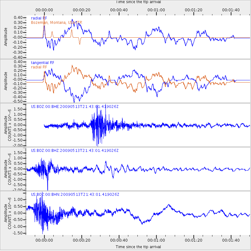
BOZ Bozeman, Montana, USA - Earthquake Result Viewer
*The percent match for this event was below the threshold and hence no stack was calculated.
| Earthquake location: |
Tonga Islands |
| Earthquake latitude/longitude: |
-15.8/-173.5 |
| Earthquake time(UTC): |
2009/05/13 (133) 21:31:17 GMT |
| Earthquake Depth: |
85 km |
| Earthquake Magnitude: |
5.8 MW, 5.3 MB, 5.8 MW |
| Earthquake Catalog/Contributor: |
WHDF/NEIC |
|
| Network: |
US United States National Seismic Network |
| Station: |
BOZ Bozeman, Montana, USA |
| Lat/Lon: |
45.65 N/111.63 W |
| Elevation: |
1589 m |
|
| Distance: |
82.7 deg |
| Az: |
38.576 deg |
| Baz: |
238.867 deg |
| Ray Param: |
$rayparam |
*The percent match for this event was below the threshold and hence was not used in the summary stack. |
|
| Radial Match: |
31.15765 % |
| Radial Bump: |
400 |
| Transverse Match: |
25.023054 % |
| Transverse Bump: |
400 |
| SOD ConfigId: |
2760 |
| Insert Time: |
2010-03-05 04:36:26.756 +0000 |
| GWidth: |
2.5 |
| Max Bumps: |
400 |
| Tol: |
0.001 |
|
Signal To Noise
| Channel | StoN | STA | LTA |
| US:BOZ:00:BHZ:20090513T21:43:01.419026Z | 6.271047 | 5.4179674E-7 | 8.639653E-8 |
| US:BOZ:00:BHN:20090513T21:43:01.419026Z | 1.7280846 | 5.1715165E-7 | 2.9926292E-7 |
| US:BOZ:00:BHE:20090513T21:43:01.419026Z | 5.1551557 | 6.827956E-7 | 1.3244907E-7 |
| Arrivals |
| Ps | |
| PpPs | |
| PsPs/PpSs | |


