You are here: Home > Network List > US - United States National Seismic Network Stations List
> Station BOZ Bozeman, Montana, USA > Earthquake Result Viewer
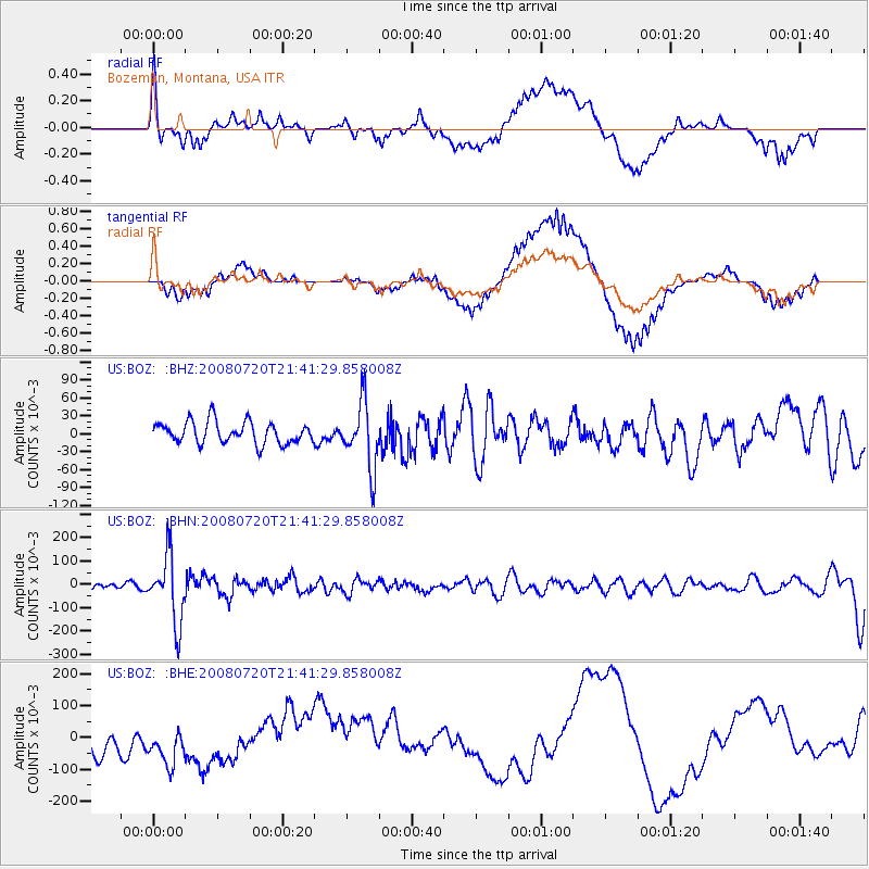
BOZ Bozeman, Montana, USA - Earthquake Result Viewer
*The percent match for this event was below the threshold and hence no stack was calculated.
| Earthquake location: |
Bonin Islands, Japan Region |
| Earthquake latitude/longitude: |
27.8/139.6 |
| Earthquake time(UTC): |
2008/07/20 (202) 21:30:29 GMT |
| Earthquake Depth: |
481 km |
| Earthquake Magnitude: |
5.8 MW, 5.1 MB, 5.8 MW |
| Earthquake Catalog/Contributor: |
WHDF/NEIC |
|
| Network: |
US United States National Seismic Network |
| Station: |
BOZ Bozeman, Montana, USA |
| Lat/Lon: |
45.65 N/111.63 W |
| Elevation: |
1589 m |
|
| Distance: |
82.5 deg |
| Az: |
42.064 deg |
| Baz: |
302.192 deg |
| Ray Param: |
$rayparam |
*The percent match for this event was below the threshold and hence was not used in the summary stack. |
|
| Radial Match: |
49.934757 % |
| Radial Bump: |
400 |
| Transverse Match: |
38.545555 % |
| Transverse Bump: |
400 |
| SOD ConfigId: |
2504 |
| Insert Time: |
2010-03-05 04:36:59.768 +0000 |
| GWidth: |
2.5 |
| Max Bumps: |
400 |
| Tol: |
0.001 |
|
Signal To Noise
| Channel | StoN | STA | LTA |
| US:BOZ: :BHN:20080720T21:41:29.858008Z | 4.828425 | 0.14217871 | 0.029446192 |
| US:BOZ: :BHE:20080720T21:41:29.858008Z | 1.5078076 | 0.07424189 | 0.049238306 |
| US:BOZ: :BHZ:20080720T21:41:29.858008Z | 2.9868376 | 0.054375287 | 0.018204968 |
| Arrivals |
| Ps | |
| PpPs | |
| PsPs/PpSs | |


