You are here: Home > Network List > TA - USArray Transportable Network (new EarthScope stations) Stations List
> Station P17K Kvichak River, AK, USA > Earthquake Result Viewer
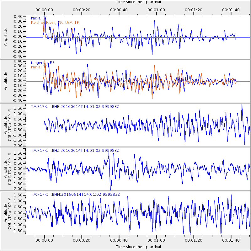
P17K Kvichak River, AK, USA - Earthquake Result Viewer
*The percent match for this event was below the threshold and hence no stack was calculated.
| Earthquake location: |
Vanuatu Islands |
| Earthquake latitude/longitude: |
-18.8/168.8 |
| Earthquake time(UTC): |
2016/06/14 (166) 13:49:22 GMT |
| Earthquake Depth: |
111 km |
| Earthquake Magnitude: |
6.2 MWW, 6.2 MWB |
| Earthquake Catalog/Contributor: |
NEIC PDE/NEIC COMCAT |
|
| Network: |
TA USArray Transportable Network (new EarthScope stations) |
| Station: |
P17K Kvichak River, AK, USA |
| Lat/Lon: |
59.20 N/156.44 W |
| Elevation: |
91 m |
|
| Distance: |
82.7 deg |
| Az: |
17.197 deg |
| Baz: |
212.978 deg |
| Ray Param: |
$rayparam |
*The percent match for this event was below the threshold and hence was not used in the summary stack. |
|
| Radial Match: |
68.02461 % |
| Radial Bump: |
400 |
| Transverse Match: |
69.02235 % |
| Transverse Bump: |
400 |
| SOD ConfigId: |
7422571 |
| Insert Time: |
2019-04-22 20:32:43.246 +0000 |
| GWidth: |
2.5 |
| Max Bumps: |
400 |
| Tol: |
0.001 |
|
Signal To Noise
| Channel | StoN | STA | LTA |
| TA:P17K: :BHZ:20160614T14:01:02.999983Z | 4.9842987 | 5.333556E-7 | 1.07007146E-7 |
| TA:P17K: :BHN:20160614T14:01:02.999983Z | 1.1593754 | 4.0062986E-7 | 3.4555663E-7 |
| TA:P17K: :BHE:20160614T14:01:02.999983Z | 0.9914539 | 3.1799175E-7 | 3.2073274E-7 |
| Arrivals |
| Ps | |
| PpPs | |
| PsPs/PpSs | |


