You are here: Home > Network List > UW - Pacific Northwest Regional Seismic Network Stations List
> Station MRBL Marblemount, WA, USA > Earthquake Result Viewer
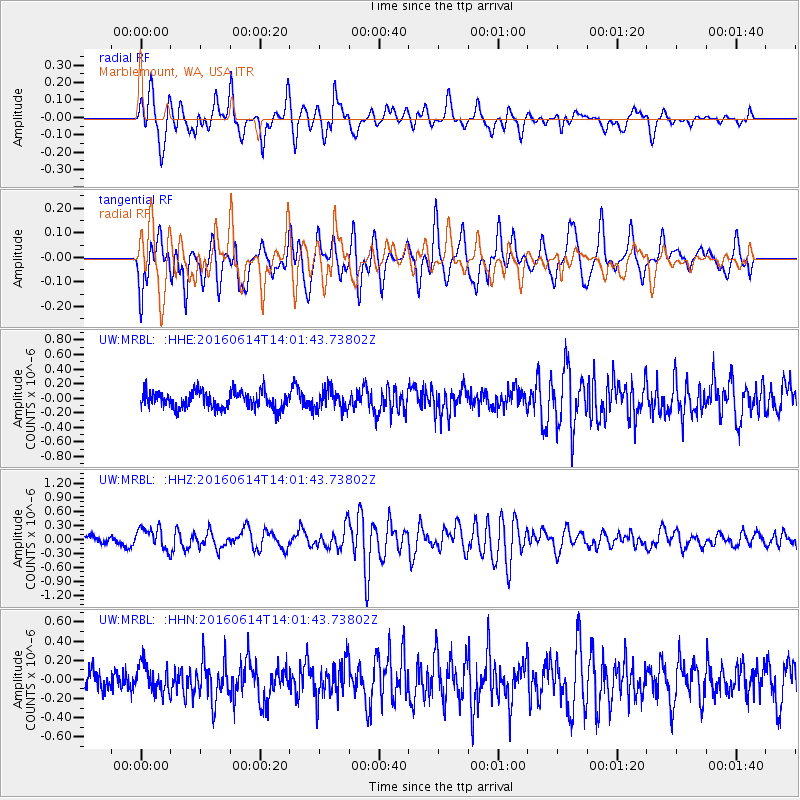
MRBL Marblemount, WA, USA - Earthquake Result Viewer
*The percent match for this event was below the threshold and hence no stack was calculated.
| Earthquake location: |
Vanuatu Islands |
| Earthquake latitude/longitude: |
-18.8/168.8 |
| Earthquake time(UTC): |
2016/06/14 (166) 13:49:22 GMT |
| Earthquake Depth: |
111 km |
| Earthquake Magnitude: |
6.2 MWW, 6.2 MWB |
| Earthquake Catalog/Contributor: |
NEIC PDE/NEIC COMCAT |
|
| Network: |
UW Pacific Northwest Regional Seismic Network |
| Station: |
MRBL Marblemount, WA, USA |
| Lat/Lon: |
48.52 N/121.48 W |
| Elevation: |
75 m |
|
| Distance: |
91.2 deg |
| Az: |
38.586 deg |
| Baz: |
242.722 deg |
| Ray Param: |
$rayparam |
*The percent match for this event was below the threshold and hence was not used in the summary stack. |
|
| Radial Match: |
64.24907 % |
| Radial Bump: |
400 |
| Transverse Match: |
73.70542 % |
| Transverse Bump: |
400 |
| SOD ConfigId: |
7422571 |
| Insert Time: |
2019-04-22 20:33:23.649 +0000 |
| GWidth: |
2.5 |
| Max Bumps: |
400 |
| Tol: |
0.001 |
|
Signal To Noise
| Channel | StoN | STA | LTA |
| UW:MRBL: :HHZ:20160614T14:01:43.73802Z | 2.8003397 | 2.3068579E-7 | 8.237778E-8 |
| UW:MRBL: :HHN:20160614T14:01:43.73802Z | 1.1872685 | 1.4526178E-7 | 1.2234956E-7 |
| UW:MRBL: :HHE:20160614T14:01:43.73802Z | 1.1835988 | 1.3646185E-7 | 1.15294014E-7 |
| Arrivals |
| Ps | |
| PpPs | |
| PsPs/PpSs | |


