You are here: Home > Network List > US - United States National Seismic Network Stations List
> Station BOZ Bozeman, Montana, USA > Earthquake Result Viewer
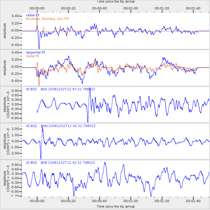
BOZ Bozeman, Montana, USA - Earthquake Result Viewer
*The percent match for this event was below the threshold and hence no stack was calculated.
| Earthquake location: |
Mariana Islands |
| Earthquake latitude/longitude: |
19.1/145.8 |
| Earthquake time(UTC): |
2008/12/02 (337) 12:31:43 GMT |
| Earthquake Depth: |
137 km |
| Earthquake Magnitude: |
5.9 MB, 5.9 MW, 5.9 MW |
| Earthquake Catalog/Contributor: |
WHDF/NEIC |
|
| Network: |
US United States National Seismic Network |
| Station: |
BOZ Bozeman, Montana, USA |
| Lat/Lon: |
45.65 N/111.63 W |
| Elevation: |
1589 m |
|
| Distance: |
85.0 deg |
| Az: |
43.403 deg |
| Baz: |
292.143 deg |
| Ray Param: |
$rayparam |
*The percent match for this event was below the threshold and hence was not used in the summary stack. |
|
| Radial Match: |
64.23683 % |
| Radial Bump: |
400 |
| Transverse Match: |
54.144943 % |
| Transverse Bump: |
400 |
| SOD ConfigId: |
2658 |
| Insert Time: |
2010-03-05 04:37:39.906 +0000 |
| GWidth: |
2.5 |
| Max Bumps: |
400 |
| Tol: |
0.001 |
|
Signal To Noise
| Channel | StoN | STA | LTA |
| US:BOZ: :BHN:20081202T12:43:32.78802Z | 5.506545 | 1.1178937E-6 | 2.0301182E-7 |
| US:BOZ: :BHE:20081202T12:43:32.78802Z | 1.1718221 | 3.7747782E-7 | 3.2212895E-7 |
| US:BOZ: :BHZ:20081202T12:43:32.78802Z | 2.6554258 | 5.209072E-7 | 1.9616711E-7 |
| Arrivals |
| Ps | |
| PpPs | |
| PsPs/PpSs | |


