You are here: Home > Network List > TA - USArray Transportable Network (new EarthScope stations) Stations List
> Station J26L Joseph Creek, AK, USA > Earthquake Result Viewer
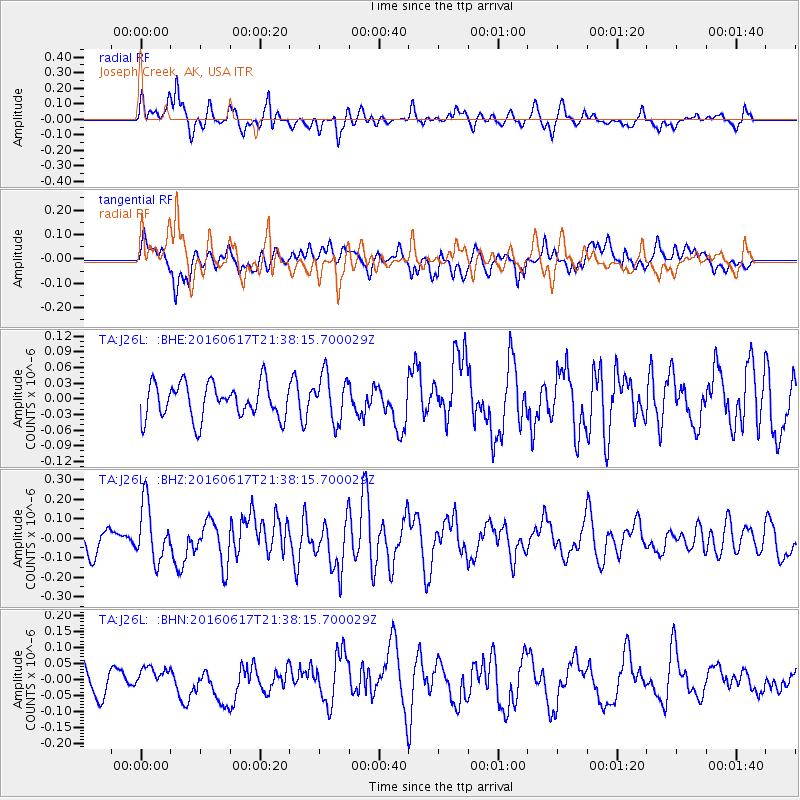
J26L Joseph Creek, AK, USA - Earthquake Result Viewer
*The percent match for this event was below the threshold and hence no stack was calculated.
| Earthquake location: |
Santa Cruz Islands |
| Earthquake latitude/longitude: |
-11.6/166.3 |
| Earthquake time(UTC): |
2016/06/17 (169) 21:26:17 GMT |
| Earthquake Depth: |
43 km |
| Earthquake Magnitude: |
5.7 MWC, 5.7 MWC |
| Earthquake Catalog/Contributor: |
NEIC PDE/NEIC COMCAT |
|
| Network: |
TA USArray Transportable Network (new EarthScope stations) |
| Station: |
J26L Joseph Creek, AK, USA |
| Lat/Lon: |
64.50 N/143.56 W |
| Elevation: |
1144 m |
|
| Distance: |
84.7 deg |
| Az: |
19.479 deg |
| Baz: |
229.012 deg |
| Ray Param: |
$rayparam |
*The percent match for this event was below the threshold and hence was not used in the summary stack. |
|
| Radial Match: |
67.81944 % |
| Radial Bump: |
400 |
| Transverse Match: |
51.396763 % |
| Transverse Bump: |
400 |
| SOD ConfigId: |
7422571 |
| Insert Time: |
2019-04-22 20:55:35.692 +0000 |
| GWidth: |
2.5 |
| Max Bumps: |
400 |
| Tol: |
0.001 |
|
Signal To Noise
| Channel | StoN | STA | LTA |
| TA:J26L: :BHZ:20160617T21:38:15.700029Z | 1.778384 | 1.4493223E-7 | 8.1496594E-8 |
| TA:J26L: :BHN:20160617T21:38:15.700029Z | 0.57883096 | 3.4351782E-8 | 5.934683E-8 |
| TA:J26L: :BHE:20160617T21:38:15.700029Z | 1.3455657 | 4.516402E-8 | 3.356508E-8 |
| Arrivals |
| Ps | |
| PpPs | |
| PsPs/PpSs | |


