You are here: Home > Network List > CI - Caltech Regional Seismic Network Stations List
> Station MPP McPhearson Peak > Earthquake Result Viewer
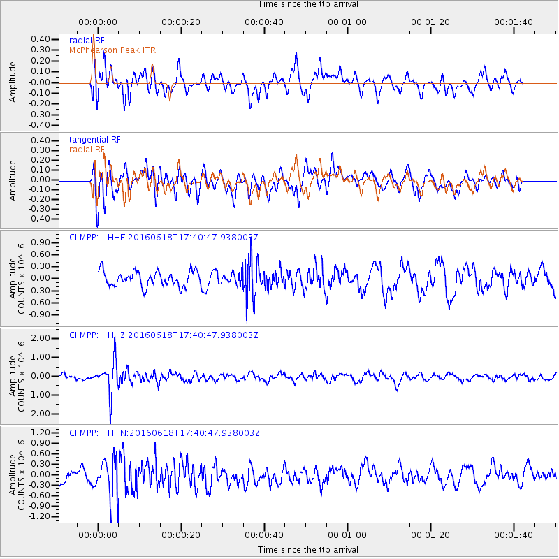
MPP McPhearson Peak - Earthquake Result Viewer
*The percent match for this event was below the threshold and hence no stack was calculated.
| Earthquake location: |
Chile-Argentina Border Region |
| Earthquake latitude/longitude: |
-24.2/-67.1 |
| Earthquake time(UTC): |
2016/06/18 (170) 17:29:44 GMT |
| Earthquake Depth: |
167 km |
| Earthquake Magnitude: |
5.5 MB |
| Earthquake Catalog/Contributor: |
NEIC PDE/NEIC COMCAT |
|
| Network: |
CI Caltech Regional Seismic Network |
| Station: |
MPP McPhearson Peak |
| Lat/Lon: |
34.89 N/119.81 W |
| Elevation: |
1739 m |
|
| Distance: |
77.2 deg |
| Az: |
317.859 deg |
| Baz: |
131.821 deg |
| Ray Param: |
$rayparam |
*The percent match for this event was below the threshold and hence was not used in the summary stack. |
|
| Radial Match: |
56.186142 % |
| Radial Bump: |
400 |
| Transverse Match: |
69.53036 % |
| Transverse Bump: |
400 |
| SOD ConfigId: |
7422571 |
| Insert Time: |
2019-04-22 21:00:17.356 +0000 |
| GWidth: |
2.5 |
| Max Bumps: |
400 |
| Tol: |
0.001 |
|
Signal To Noise
| Channel | StoN | STA | LTA |
| CI:MPP: :HHZ:20160618T17:40:47.938003Z | 4.695308 | 8.656674E-7 | 1.843686E-7 |
| CI:MPP: :HHN:20160618T17:40:47.938003Z | 2.3389282 | 5.6793783E-7 | 2.428197E-7 |
| CI:MPP: :HHE:20160618T17:40:47.938003Z | 1.5009252 | 2.7839184E-7 | 1.8548015E-7 |
| Arrivals |
| Ps | |
| PpPs | |
| PsPs/PpSs | |


