You are here: Home > Network List > GS - US Geological Survey Networks Stations List
> Station KAN10 Keim Farm, Anthony, KS, USA > Earthquake Result Viewer
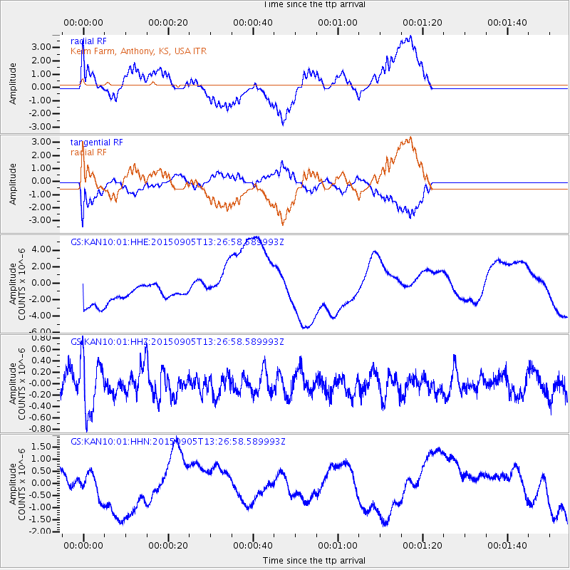
KAN10 Keim Farm, Anthony, KS, USA - Earthquake Result Viewer
*The percent match for this event was below the threshold and hence no stack was calculated.
| Earthquake location: |
Kuril Islands |
| Earthquake latitude/longitude: |
49.4/155.6 |
| Earthquake time(UTC): |
2015/09/05 (248) 13:16:10 GMT |
| Earthquake Depth: |
47 km |
| Earthquake Magnitude: |
5.9 MWB |
| Earthquake Catalog/Contributor: |
NEIC PDE/NEIC COMCAT |
|
| Network: |
GS US Geological Survey Networks |
| Station: |
KAN10 Keim Farm, Anthony, KS, USA |
| Lat/Lon: |
37.12 N/98.10 W |
| Elevation: |
417 m |
|
| Distance: |
72.0 deg |
| Az: |
53.762 deg |
| Baz: |
318.711 deg |
| Ray Param: |
$rayparam |
*The percent match for this event was below the threshold and hence was not used in the summary stack. |
|
| Radial Match: |
35.936604 % |
| Radial Bump: |
293 |
| Transverse Match: |
32.76256 % |
| Transverse Bump: |
355 |
| SOD ConfigId: |
1156111 |
| Insert Time: |
2015-09-19 13:34:06.234 +0000 |
| GWidth: |
2.5 |
| Max Bumps: |
400 |
| Tol: |
0.001 |
|
Signal To Noise
| Channel | StoN | STA | LTA |
| GS:KAN10:01:HHZ:20150905T13:26:58.589993Z | 2.6238177 | 4.6955626E-7 | 1.7895917E-7 |
| GS:KAN10:01:HHN:20150905T13:26:58.589993Z | 0.9896357 | 6.0289136E-7 | 6.0920536E-7 |
| GS:KAN10:01:HHE:20150905T13:26:58.589993Z | 2.7196336 | 2.6474208E-6 | 9.734476E-7 |
| Arrivals |
| Ps | |
| PpPs | |
| PsPs/PpSs | |


