You are here: Home > Network List > US - United States National Seismic Network Stations List
> Station GLMI Grayling, Michigan, USA > Earthquake Result Viewer
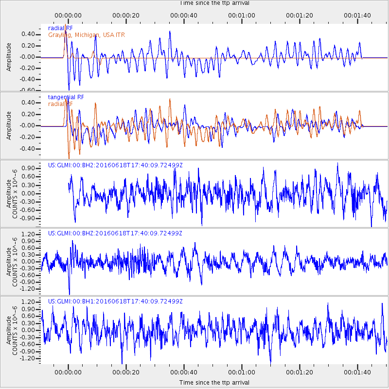
GLMI Grayling, Michigan, USA - Earthquake Result Viewer
*The percent match for this event was below the threshold and hence no stack was calculated.
| Earthquake location: |
Chile-Argentina Border Region |
| Earthquake latitude/longitude: |
-24.2/-67.1 |
| Earthquake time(UTC): |
2016/06/18 (170) 17:29:44 GMT |
| Earthquake Depth: |
167 km |
| Earthquake Magnitude: |
5.5 MB |
| Earthquake Catalog/Contributor: |
NEIC PDE/NEIC COMCAT |
|
| Network: |
US United States National Seismic Network |
| Station: |
GLMI Grayling, Michigan, USA |
| Lat/Lon: |
44.82 N/84.62 W |
| Elevation: |
387 m |
|
| Distance: |
70.5 deg |
| Az: |
346.86 deg |
| Baz: |
163.042 deg |
| Ray Param: |
$rayparam |
*The percent match for this event was below the threshold and hence was not used in the summary stack. |
|
| Radial Match: |
52.458366 % |
| Radial Bump: |
400 |
| Transverse Match: |
63.99108 % |
| Transverse Bump: |
400 |
| SOD ConfigId: |
7422571 |
| Insert Time: |
2019-04-22 21:07:13.632 +0000 |
| GWidth: |
2.5 |
| Max Bumps: |
400 |
| Tol: |
0.001 |
|
Signal To Noise
| Channel | StoN | STA | LTA |
| US:GLMI:00:BHZ:20160618T17:40:09.72499Z | 2.0592623 | 4.7698126E-7 | 2.3162725E-7 |
| US:GLMI:00:BH1:20160618T17:40:09.72499Z | 1.4031796 | 5.3768287E-7 | 3.831889E-7 |
| US:GLMI:00:BH2:20160618T17:40:09.72499Z | 0.91848713 | 2.868181E-7 | 3.1227233E-7 |
| Arrivals |
| Ps | |
| PpPs | |
| PsPs/PpSs | |


