You are here: Home > Network List > UW - Pacific Northwest Regional Seismic Network Stations List
> Station MRBL Marblemount, WA, USA > Earthquake Result Viewer
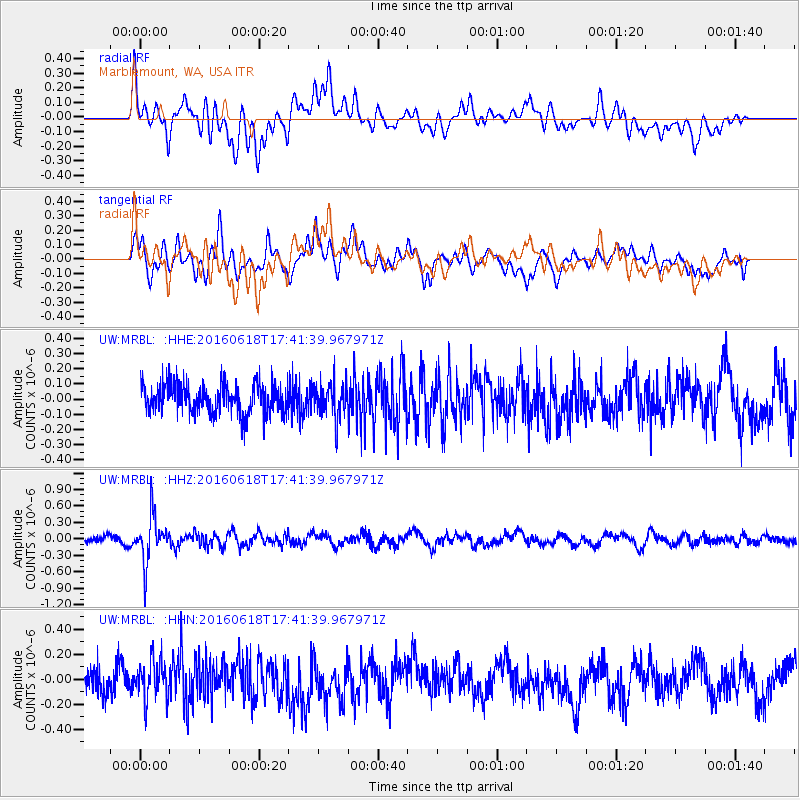
MRBL Marblemount, WA, USA - Earthquake Result Viewer
*The percent match for this event was below the threshold and hence no stack was calculated.
| Earthquake location: |
Chile-Argentina Border Region |
| Earthquake latitude/longitude: |
-24.2/-67.1 |
| Earthquake time(UTC): |
2016/06/18 (170) 17:29:44 GMT |
| Earthquake Depth: |
167 km |
| Earthquake Magnitude: |
5.5 MB |
| Earthquake Catalog/Contributor: |
NEIC PDE/NEIC COMCAT |
|
| Network: |
UW Pacific Northwest Regional Seismic Network |
| Station: |
MRBL Marblemount, WA, USA |
| Lat/Lon: |
48.52 N/121.48 W |
| Elevation: |
75 m |
|
| Distance: |
87.2 deg |
| Az: |
327.232 deg |
| Baz: |
131.989 deg |
| Ray Param: |
$rayparam |
*The percent match for this event was below the threshold and hence was not used in the summary stack. |
|
| Radial Match: |
60.413498 % |
| Radial Bump: |
400 |
| Transverse Match: |
59.89393 % |
| Transverse Bump: |
400 |
| SOD ConfigId: |
7422571 |
| Insert Time: |
2019-04-22 21:07:35.735 +0000 |
| GWidth: |
2.5 |
| Max Bumps: |
400 |
| Tol: |
0.001 |
|
Signal To Noise
| Channel | StoN | STA | LTA |
| UW:MRBL: :HHZ:20160618T17:41:39.967971Z | 6.6617627 | 4.231052E-7 | 6.35125E-8 |
| UW:MRBL: :HHN:20160618T17:41:39.967971Z | 1.5227895 | 1.5829917E-7 | 1.03953425E-7 |
| UW:MRBL: :HHE:20160618T17:41:39.967971Z | 1.2648315 | 1.2111039E-7 | 9.5752185E-8 |
| Arrivals |
| Ps | |
| PpPs | |
| PsPs/PpSs | |


