You are here: Home > Network List > TJ - Tajikistan National Seismic Network Stations List
> Station GARM Garm, Tajikistan > Earthquake Result Viewer
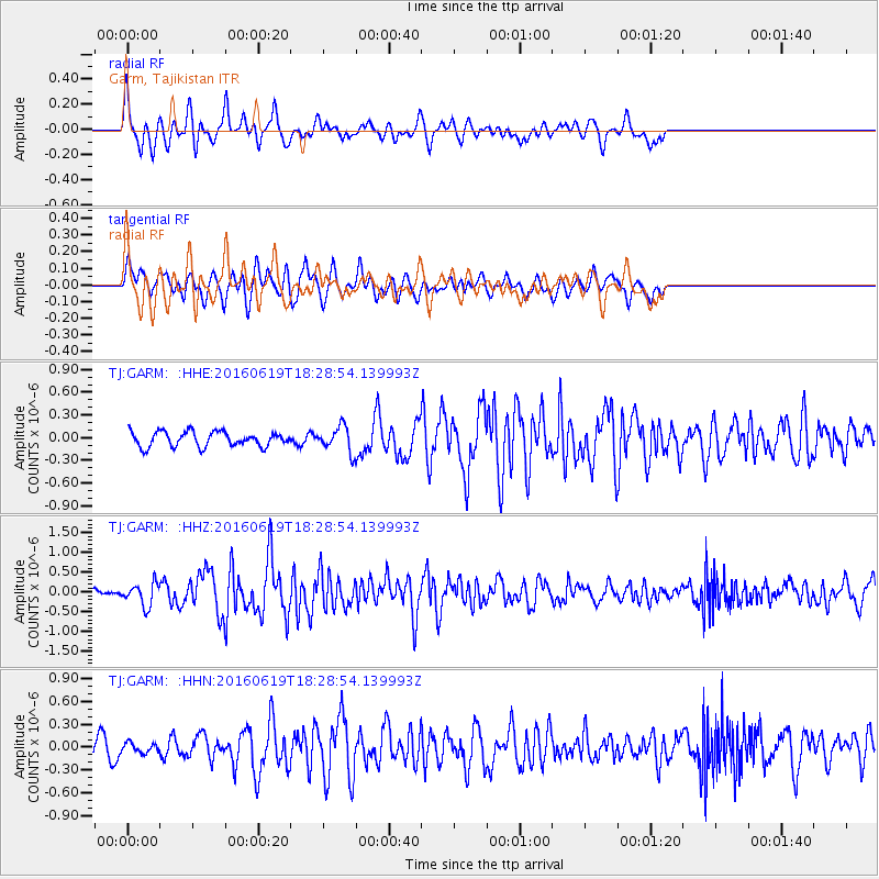
GARM Garm, Tajikistan - Earthquake Result Viewer
*The percent match for this event was below the threshold and hence no stack was calculated.
| Earthquake location: |
Philippine Islands Region |
| Earthquake latitude/longitude: |
20.1/121.4 |
| Earthquake time(UTC): |
2016/06/19 (171) 18:20:50 GMT |
| Earthquake Depth: |
18 km |
| Earthquake Magnitude: |
5.6 MWW, 5.4 MWB |
| Earthquake Catalog/Contributor: |
NEIC PDE/NEIC COMCAT |
|
| Network: |
TJ Tajikistan National Seismic Network |
| Station: |
GARM Garm, Tajikistan |
| Lat/Lon: |
39.00 N/70.32 E |
| Elevation: |
1305 m |
|
| Distance: |
47.6 deg |
| Az: |
304.801 deg |
| Baz: |
98.043 deg |
| Ray Param: |
$rayparam |
*The percent match for this event was below the threshold and hence was not used in the summary stack. |
|
| Radial Match: |
73.010475 % |
| Radial Bump: |
400 |
| Transverse Match: |
61.420685 % |
| Transverse Bump: |
400 |
| SOD ConfigId: |
7422571 |
| Insert Time: |
2019-04-22 21:22:09.824 +0000 |
| GWidth: |
2.5 |
| Max Bumps: |
400 |
| Tol: |
0.001 |
|
Signal To Noise
| Channel | StoN | STA | LTA |
| TJ:GARM: :HHZ:20160619T18:28:54.139993Z | 2.2486906 | 2.7682785E-7 | 1.2310623E-7 |
| TJ:GARM: :HHN:20160619T18:28:54.139993Z | 0.9154913 | 6.119733E-8 | 6.684645E-8 |
| TJ:GARM: :HHE:20160619T18:28:54.139993Z | 1.8543469 | 1.7889703E-7 | 9.6474416E-8 |
| Arrivals |
| Ps | |
| PpPs | |
| PsPs/PpSs | |


