You are here: Home > Network List > UW - Pacific Northwest Regional Seismic Network Stations List
> Station FISH Seaside, OR, USA > Earthquake Result Viewer
FISH Seaside, OR, USA - Earthquake Result Viewer
*The percent match for this event was below the threshold and hence no stack was calculated.
| Earthquake location: |
Philippine Islands Region |
| Earthquake latitude/longitude: |
20.1/121.4 |
| Earthquake time(UTC): |
2016/06/19 (171) 18:20:50 GMT |
| Earthquake Depth: |
18 km |
| Earthquake Magnitude: |
5.6 MWW, 5.4 MWB |
| Earthquake Catalog/Contributor: |
NEIC PDE/NEIC COMCAT |
|
| Network: |
UW Pacific Northwest Regional Seismic Network |
| Station: |
FISH Seaside, OR, USA |
| Lat/Lon: |
45.93 N/123.56 W |
| Elevation: |
325 m |
|
| Distance: |
91.9 deg |
| Az: |
39.245 deg |
| Baz: |
301.603 deg |
| Ray Param: |
$rayparam |
*The percent match for this event was below the threshold and hence was not used in the summary stack. |
|
| Radial Match: |
39.230568 % |
| Radial Bump: |
400 |
| Transverse Match: |
23.806599 % |
| Transverse Bump: |
400 |
| SOD ConfigId: |
7422571 |
| Insert Time: |
2019-04-22 21:22:17.089 +0000 |
| GWidth: |
2.5 |
| Max Bumps: |
400 |
| Tol: |
0.001 |
|
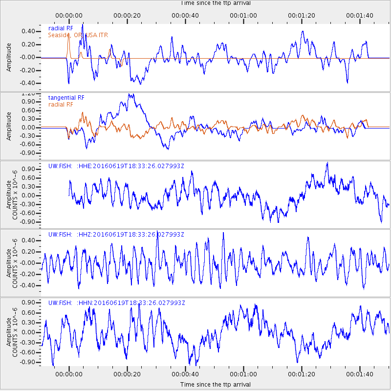
Signal To Noise
| Channel | StoN | STA | LTA |
| UW:FISH: :HHZ:20160619T18:33:26.027993Z | 1.4800693 | 2.0912137E-7 | 1.4129161E-7 |
| UW:FISH: :HHN:20160619T18:33:26.027993Z | 0.8659525 | 4.0275674E-7 | 4.651026E-7 |
| UW:FISH: :HHE:20160619T18:33:26.027993Z | 1.1823748 | 3.184551E-7 | 2.6933515E-7 |
| Arrivals |
| Ps | |
| PpPs | |
| PsPs/PpSs | |


