You are here: Home > Network List > CI - Caltech Regional Seismic Network Stations List
> Station SHO Shoshone, CA, USA > Earthquake Result Viewer
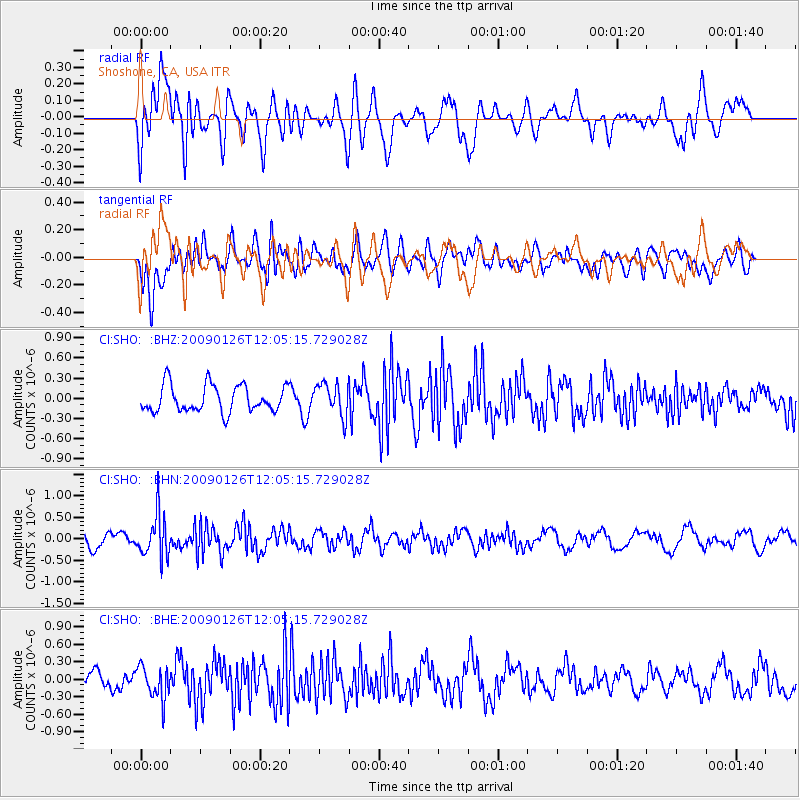
SHO Shoshone, CA, USA - Earthquake Result Viewer
*The percent match for this event was below the threshold and hence no stack was calculated.
| Earthquake location: |
Fiji Islands Region |
| Earthquake latitude/longitude: |
-17.8/-178.6 |
| Earthquake time(UTC): |
2009/01/26 (026) 11:54:39 GMT |
| Earthquake Depth: |
580 km |
| Earthquake Magnitude: |
5.5 MB, 5.8 MW, 5.8 MW |
| Earthquake Catalog/Contributor: |
WHDF/NEIC |
|
| Network: |
CI Caltech Regional Seismic Network |
| Station: |
SHO Shoshone, CA, USA |
| Lat/Lon: |
35.90 N/116.28 W |
| Elevation: |
451 m |
|
| Distance: |
79.5 deg |
| Az: |
46.986 deg |
| Baz: |
239.094 deg |
| Ray Param: |
$rayparam |
*The percent match for this event was below the threshold and hence was not used in the summary stack. |
|
| Radial Match: |
60.634495 % |
| Radial Bump: |
400 |
| Transverse Match: |
49.47817 % |
| Transverse Bump: |
400 |
| SOD ConfigId: |
2658 |
| Insert Time: |
2010-02-26 00:30:28.710 +0000 |
| GWidth: |
2.5 |
| Max Bumps: |
400 |
| Tol: |
0.001 |
|
Signal To Noise
| Channel | StoN | STA | LTA |
| CI:SHO: :BHN:20090126T12:05:15.729028Z | 3.583877 | 4.957894E-7 | 1.3833883E-7 |
| CI:SHO: :BHE:20090126T12:05:15.729028Z | 1.3788121 | 2.7794206E-7 | 2.015808E-7 |
| CI:SHO: :BHZ:20090126T12:05:15.729028Z | 1.222822 | 2.4273243E-7 | 1.9850184E-7 |
| Arrivals |
| Ps | |
| PpPs | |
| PsPs/PpSs | |


