You are here: Home > Network List > US - United States National Seismic Network Stations List
> Station HAWA Hanford, Washington, USA > Earthquake Result Viewer
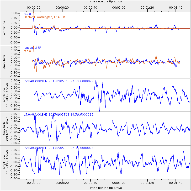
HAWA Hanford, Washington, USA - Earthquake Result Viewer
*The percent match for this event was below the threshold and hence no stack was calculated.
| Earthquake location: |
Kuril Islands |
| Earthquake latitude/longitude: |
49.4/155.6 |
| Earthquake time(UTC): |
2015/09/05 (248) 13:16:10 GMT |
| Earthquake Depth: |
47 km |
| Earthquake Magnitude: |
5.9 MWB |
| Earthquake Catalog/Contributor: |
NEIC PDE/NEIC COMCAT |
|
| Network: |
US United States National Seismic Network |
| Station: |
HAWA Hanford, Washington, USA |
| Lat/Lon: |
46.39 N/119.53 W |
| Elevation: |
364 m |
|
| Distance: |
54.1 deg |
| Az: |
58.359 deg |
| Baz: |
306.457 deg |
| Ray Param: |
$rayparam |
*The percent match for this event was below the threshold and hence was not used in the summary stack. |
|
| Radial Match: |
60.559814 % |
| Radial Bump: |
400 |
| Transverse Match: |
69.279594 % |
| Transverse Bump: |
400 |
| SOD ConfigId: |
1156111 |
| Insert Time: |
2015-09-19 13:40:49.284 +0000 |
| GWidth: |
2.5 |
| Max Bumps: |
400 |
| Tol: |
0.001 |
|
Signal To Noise
| Channel | StoN | STA | LTA |
| US:HAWA:00:BHZ:20150905T13:24:59.600002Z | 3.5245993 | 3.4252352E-7 | 9.718084E-8 |
| US:HAWA:00:BH1:20150905T13:24:59.600002Z | 2.0683281 | 2.1933604E-7 | 1.06045086E-7 |
| US:HAWA:00:BH2:20150905T13:24:59.600002Z | 1.8191212 | 1.17193586E-7 | 6.442319E-8 |
| Arrivals |
| Ps | |
| PpPs | |
| PsPs/PpSs | |


