You are here: Home > Network List > TA - USArray Transportable Network (new EarthScope stations) Stations List
> Station J26L Joseph Creek, AK, USA > Earthquake Result Viewer
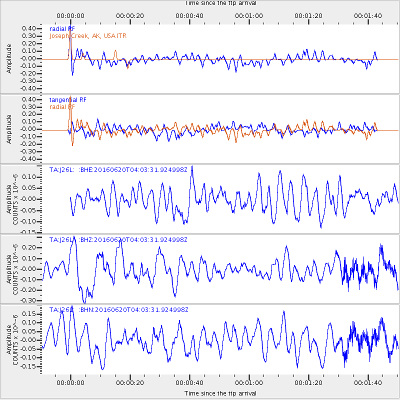
J26L Joseph Creek, AK, USA - Earthquake Result Viewer
*The percent match for this event was below the threshold and hence no stack was calculated.
| Earthquake location: |
Loyalty Islands |
| Earthquake latitude/longitude: |
-20.2/168.8 |
| Earthquake time(UTC): |
2016/06/20 (172) 03:50:55 GMT |
| Earthquake Depth: |
15 km |
| Earthquake Magnitude: |
6.0 MWW, 5.8 MWB, 5.9 MWC, 6.0 MWC |
| Earthquake Catalog/Contributor: |
NEIC PDE/NEIC COMCAT |
|
| Network: |
TA USArray Transportable Network (new EarthScope stations) |
| Station: |
J26L Joseph Creek, AK, USA |
| Lat/Lon: |
64.50 N/143.56 W |
| Elevation: |
1144 m |
|
| Distance: |
92.1 deg |
| Az: |
18.677 deg |
| Baz: |
224.015 deg |
| Ray Param: |
$rayparam |
*The percent match for this event was below the threshold and hence was not used in the summary stack. |
|
| Radial Match: |
43.38541 % |
| Radial Bump: |
400 |
| Transverse Match: |
45.95533 % |
| Transverse Bump: |
400 |
| SOD ConfigId: |
7422571 |
| Insert Time: |
2019-04-22 21:28:48.670 +0000 |
| GWidth: |
2.5 |
| Max Bumps: |
400 |
| Tol: |
0.001 |
|
Signal To Noise
| Channel | StoN | STA | LTA |
| TA:J26L: :BHZ:20160620T04:03:31.924998Z | 2.334231 | 2.1566784E-7 | 9.2393535E-8 |
| TA:J26L: :BHN:20160620T04:03:31.924998Z | 1.4654769 | 1.0303499E-7 | 7.030816E-8 |
| TA:J26L: :BHE:20160620T04:03:31.924998Z | 1.5107306 | 5.475157E-8 | 3.6241783E-8 |
| Arrivals |
| Ps | |
| PpPs | |
| PsPs/PpSs | |


