You are here: Home > Network List > TA - USArray Transportable Network (new EarthScope stations) Stations List
> Station R11A Troy Canyon, Currant, NV, USA > Earthquake Result Viewer
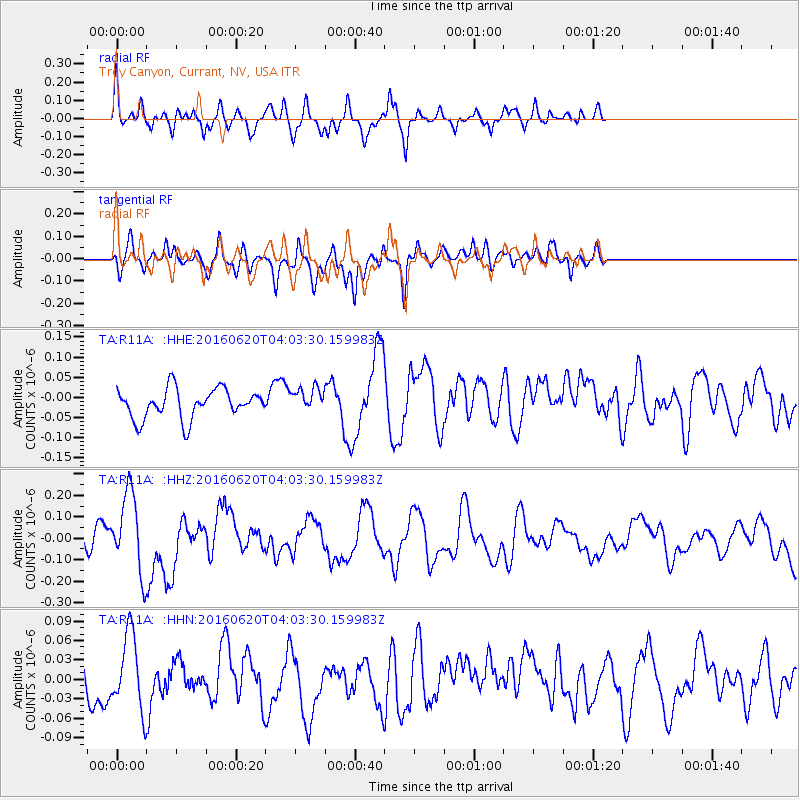
R11A Troy Canyon, Currant, NV, USA - Earthquake Result Viewer
*The percent match for this event was below the threshold and hence no stack was calculated.
| Earthquake location: |
Loyalty Islands |
| Earthquake latitude/longitude: |
-20.2/168.8 |
| Earthquake time(UTC): |
2016/06/20 (172) 03:50:55 GMT |
| Earthquake Depth: |
15 km |
| Earthquake Magnitude: |
6.0 MWW, 5.8 MWB, 5.9 MWC, 6.0 MWC |
| Earthquake Catalog/Contributor: |
NEIC PDE/NEIC COMCAT |
|
| Network: |
TA USArray Transportable Network (new EarthScope stations) |
| Station: |
R11A Troy Canyon, Currant, NV, USA |
| Lat/Lon: |
38.35 N/115.59 W |
| Elevation: |
1756 m |
|
| Distance: |
91.7 deg |
| Az: |
49.648 deg |
| Baz: |
245.547 deg |
| Ray Param: |
$rayparam |
*The percent match for this event was below the threshold and hence was not used in the summary stack. |
|
| Radial Match: |
57.582954 % |
| Radial Bump: |
400 |
| Transverse Match: |
57.927235 % |
| Transverse Bump: |
400 |
| SOD ConfigId: |
7422571 |
| Insert Time: |
2019-04-22 21:29:10.272 +0000 |
| GWidth: |
2.5 |
| Max Bumps: |
400 |
| Tol: |
0.001 |
|
Signal To Noise
| Channel | StoN | STA | LTA |
| TA:R11A: :HHZ:20160620T04:03:30.159983Z | 3.2184076 | 1.8280657E-7 | 5.680032E-8 |
| TA:R11A: :HHN:20160620T04:03:30.159983Z | 1.2445415 | 5.605845E-8 | 4.5043457E-8 |
| TA:R11A: :HHE:20160620T04:03:30.159983Z | 0.81783587 | 2.983119E-8 | 3.6475768E-8 |
| Arrivals |
| Ps | |
| PpPs | |
| PsPs/PpSs | |


