You are here: Home > Network List > US - United States National Seismic Network Stations List
> Station WMOK Wichita Mountains, Oklahoma, USA > Earthquake Result Viewer
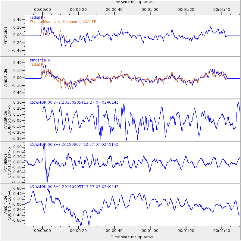
WMOK Wichita Mountains, Oklahoma, USA - Earthquake Result Viewer
*The percent match for this event was below the threshold and hence no stack was calculated.
| Earthquake location: |
Kuril Islands |
| Earthquake latitude/longitude: |
49.4/155.6 |
| Earthquake time(UTC): |
2015/09/05 (248) 13:16:10 GMT |
| Earthquake Depth: |
47 km |
| Earthquake Magnitude: |
5.9 MWB |
| Earthquake Catalog/Contributor: |
NEIC PDE/NEIC COMCAT |
|
| Network: |
US United States National Seismic Network |
| Station: |
WMOK Wichita Mountains, Oklahoma, USA |
| Lat/Lon: |
34.74 N/98.78 W |
| Elevation: |
486 m |
|
| Distance: |
73.5 deg |
| Az: |
55.842 deg |
| Baz: |
318.927 deg |
| Ray Param: |
$rayparam |
*The percent match for this event was below the threshold and hence was not used in the summary stack. |
|
| Radial Match: |
34.205776 % |
| Radial Bump: |
400 |
| Transverse Match: |
32.503304 % |
| Transverse Bump: |
400 |
| SOD ConfigId: |
1156111 |
| Insert Time: |
2015-09-19 13:42:30.605 +0000 |
| GWidth: |
2.5 |
| Max Bumps: |
400 |
| Tol: |
0.001 |
|
Signal To Noise
| Channel | StoN | STA | LTA |
| US:WMOK:00:BHZ:20150905T13:27:07.024014Z | 4.9567266 | 6.1018306E-7 | 1.2310203E-7 |
| US:WMOK:00:BH1:20150905T13:27:07.024014Z | 1.0327421 | 2.7438813E-7 | 2.6568893E-7 |
| US:WMOK:00:BH2:20150905T13:27:07.024014Z | 1.4584424 | 1.669115E-7 | 1.1444504E-7 |
| Arrivals |
| Ps | |
| PpPs | |
| PsPs/PpSs | |


