You are here: Home > Network List > CI - Caltech Regional Seismic Network Stations List
> Station BFS Mt Baldy Forest Station > Earthquake Result Viewer
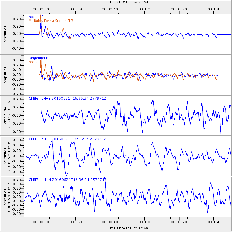
BFS Mt Baldy Forest Station - Earthquake Result Viewer
*The percent match for this event was below the threshold and hence no stack was calculated.
| Earthquake location: |
Northern Mid-Atlantic Ridge |
| Earthquake latitude/longitude: |
22.7/-45.1 |
| Earthquake time(UTC): |
2016/06/21 (173) 16:26:34 GMT |
| Earthquake Depth: |
10 km |
| Earthquake Magnitude: |
6.1 MWB |
| Earthquake Catalog/Contributor: |
NEIC PDE/NEIC COMCAT |
|
| Network: |
CI Caltech Regional Seismic Network |
| Station: |
BFS Mt Baldy Forest Station |
| Lat/Lon: |
34.24 N/117.66 W |
| Elevation: |
1312 m |
|
| Distance: |
63.6 deg |
| Az: |
298.106 deg |
| Baz: |
79.58 deg |
| Ray Param: |
$rayparam |
*The percent match for this event was below the threshold and hence was not used in the summary stack. |
|
| Radial Match: |
76.502716 % |
| Radial Bump: |
400 |
| Transverse Match: |
71.94782 % |
| Transverse Bump: |
400 |
| SOD ConfigId: |
7422571 |
| Insert Time: |
2019-04-22 21:34:29.247 +0000 |
| GWidth: |
2.5 |
| Max Bumps: |
400 |
| Tol: |
0.001 |
|
Signal To Noise
| Channel | StoN | STA | LTA |
| CI:BFS: :HHZ:20160621T16:36:34.257971Z | 2.379299 | 1.9092228E-7 | 8.024308E-8 |
| CI:BFS: :HHN:20160621T16:36:34.257971Z | 1.7504961 | 1.12081274E-7 | 6.4028285E-8 |
| CI:BFS: :HHE:20160621T16:36:34.257971Z | 1.4426764 | 1.0306171E-7 | 7.143785E-8 |
| Arrivals |
| Ps | |
| PpPs | |
| PsPs/PpSs | |


