You are here: Home > Network List > UW - Pacific Northwest Regional Seismic Network Stations List
> Station LEBA Lebam, WA, USA > Earthquake Result Viewer
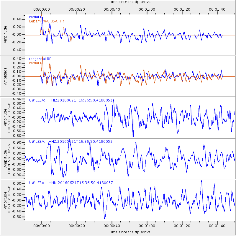
LEBA Lebam, WA, USA - Earthquake Result Viewer
*The percent match for this event was below the threshold and hence no stack was calculated.
| Earthquake location: |
Northern Mid-Atlantic Ridge |
| Earthquake latitude/longitude: |
22.7/-45.1 |
| Earthquake time(UTC): |
2016/06/21 (173) 16:26:34 GMT |
| Earthquake Depth: |
10 km |
| Earthquake Magnitude: |
6.1 MWB |
| Earthquake Catalog/Contributor: |
NEIC PDE/NEIC COMCAT |
|
| Network: |
UW Pacific Northwest Regional Seismic Network |
| Station: |
LEBA Lebam, WA, USA |
| Lat/Lon: |
46.55 N/123.56 W |
| Elevation: |
73 m |
|
| Distance: |
66.1 deg |
| Az: |
312.305 deg |
| Baz: |
81.803 deg |
| Ray Param: |
$rayparam |
*The percent match for this event was below the threshold and hence was not used in the summary stack. |
|
| Radial Match: |
67.86741 % |
| Radial Bump: |
400 |
| Transverse Match: |
64.14737 % |
| Transverse Bump: |
400 |
| SOD ConfigId: |
7422571 |
| Insert Time: |
2019-04-22 21:43:26.842 +0000 |
| GWidth: |
2.5 |
| Max Bumps: |
400 |
| Tol: |
0.001 |
|
Signal To Noise
| Channel | StoN | STA | LTA |
| UW:LEBA: :HHZ:20160621T16:36:50.418005Z | 4.746015 | 4.6336243E-7 | 9.763189E-8 |
| UW:LEBA: :HHN:20160621T16:36:50.418005Z | 1.3604118 | 1.9964041E-7 | 1.4674998E-7 |
| UW:LEBA: :HHE:20160621T16:36:50.418005Z | 1.3365029 | 1.9101363E-7 | 1.4292047E-7 |
| Arrivals |
| Ps | |
| PpPs | |
| PsPs/PpSs | |


