You are here: Home > Network List > CI - Caltech Regional Seismic Network Stations List
> Station SHO Shoshone, CA, USA > Earthquake Result Viewer
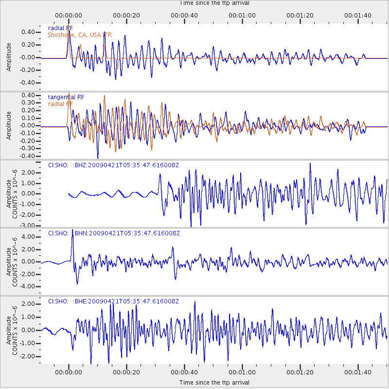
SHO Shoshone, CA, USA - Earthquake Result Viewer
*The percent match for this event was below the threshold and hence no stack was calculated.
| Earthquake location: |
Kuril Islands |
| Earthquake latitude/longitude: |
50.8/155.0 |
| Earthquake time(UTC): |
2009/04/21 (111) 05:26:11 GMT |
| Earthquake Depth: |
152 km |
| Earthquake Magnitude: |
6.0 MB, 6.2 MW, 6.2 MW |
| Earthquake Catalog/Contributor: |
WHDF/NEIC |
|
| Network: |
CI Caltech Regional Seismic Network |
| Station: |
SHO Shoshone, CA, USA |
| Lat/Lon: |
35.90 N/116.28 W |
| Elevation: |
451 m |
|
| Distance: |
62.4 deg |
| Az: |
66.311 deg |
| Baz: |
314.338 deg |
| Ray Param: |
$rayparam |
*The percent match for this event was below the threshold and hence was not used in the summary stack. |
|
| Radial Match: |
79.49158 % |
| Radial Bump: |
400 |
| Transverse Match: |
82.28384 % |
| Transverse Bump: |
400 |
| SOD ConfigId: |
2760 |
| Insert Time: |
2010-02-26 00:31:01.645 +0000 |
| GWidth: |
2.5 |
| Max Bumps: |
400 |
| Tol: |
0.001 |
|
Signal To Noise
| Channel | StoN | STA | LTA |
| CI:SHO: :BHN:20090421T05:35:47.616008Z | 11.424958 | 1.9090855E-6 | 1.6709782E-7 |
| CI:SHO: :BHE:20090421T05:35:47.616008Z | 5.040894 | 5.882471E-7 | 1.1669499E-7 |
| CI:SHO: :BHZ:20090421T05:35:47.616008Z | 5.83305 | 9.927666E-7 | 1.7019683E-7 |
| Arrivals |
| Ps | |
| PpPs | |
| PsPs/PpSs | |


