You are here: Home > Network List > CI - Caltech Regional Seismic Network Stations List
> Station SHO Shoshone, CA, USA > Earthquake Result Viewer
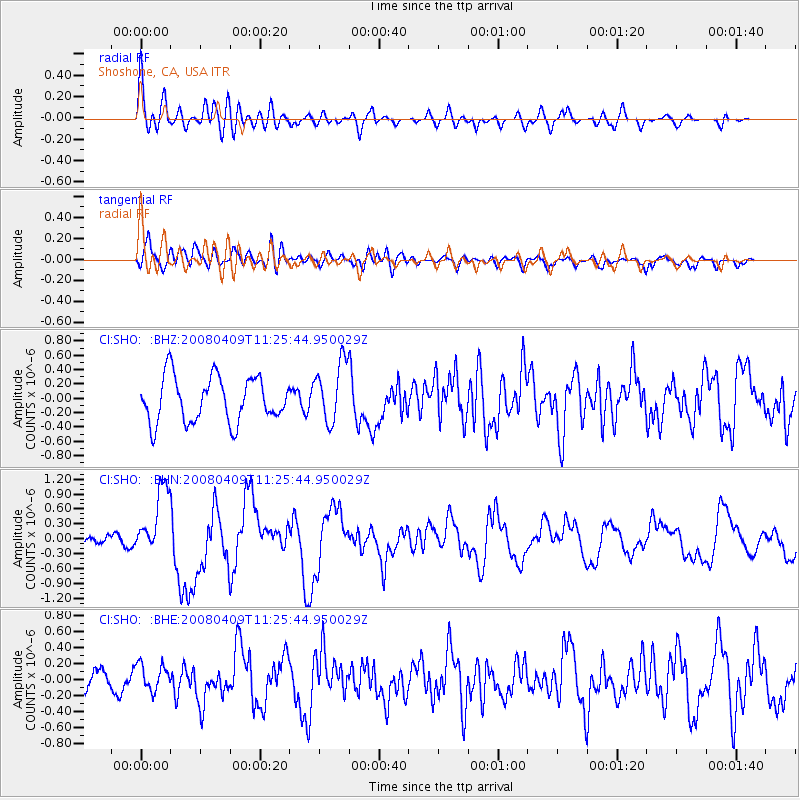
SHO Shoshone, CA, USA - Earthquake Result Viewer
*The percent match for this event was below the threshold and hence no stack was calculated.
| Earthquake location: |
Loyalty Islands |
| Earthquake latitude/longitude: |
-20.2/168.9 |
| Earthquake time(UTC): |
2008/04/09 (100) 11:13:17 GMT |
| Earthquake Depth: |
13 km |
| Earthquake Magnitude: |
5.6 MB, 6.3 MS, 6.4 MW, 6.3 MW |
| Earthquake Catalog/Contributor: |
WHDF/NEIC |
|
| Network: |
CI Caltech Regional Seismic Network |
| Station: |
SHO Shoshone, CA, USA |
| Lat/Lon: |
35.90 N/116.28 W |
| Elevation: |
451 m |
|
| Distance: |
90.1 deg |
| Az: |
51.605 deg |
| Baz: |
245.067 deg |
| Ray Param: |
$rayparam |
*The percent match for this event was below the threshold and hence was not used in the summary stack. |
|
| Radial Match: |
66.501114 % |
| Radial Bump: |
400 |
| Transverse Match: |
69.7789 % |
| Transverse Bump: |
400 |
| SOD ConfigId: |
2504 |
| Insert Time: |
2010-02-26 00:31:05.676 +0000 |
| GWidth: |
2.5 |
| Max Bumps: |
400 |
| Tol: |
0.001 |
|
Signal To Noise
| Channel | StoN | STA | LTA |
| CI:SHO: :BHN:20080409T11:25:44.950029Z | 2.7849665 | 6.793856E-7 | 2.439475E-7 |
| CI:SHO: :BHE:20080409T11:25:44.950029Z | 0.92526245 | 1.66115E-7 | 1.7953285E-7 |
| CI:SHO: :BHZ:20080409T11:25:44.950029Z | 1.3472726 | 4.2205156E-7 | 3.1326366E-7 |
| Arrivals |
| Ps | |
| PpPs | |
| PsPs/PpSs | |


