You are here: Home > Network List > CI - Caltech Regional Seismic Network Stations List
> Station SHO Shoshone, CA, USA > Earthquake Result Viewer
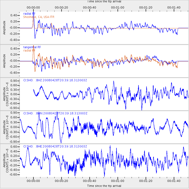
SHO Shoshone, CA, USA - Earthquake Result Viewer
*The percent match for this event was below the threshold and hence no stack was calculated.
| Earthquake location: |
Loyalty Islands |
| Earthquake latitude/longitude: |
-20.2/168.8 |
| Earthquake time(UTC): |
2008/04/28 (119) 20:26:53 GMT |
| Earthquake Depth: |
35 km |
| Earthquake Magnitude: |
5.8 MB, 5.7 MS, 6.1 MW, 6.0 MW |
| Earthquake Catalog/Contributor: |
WHDF/NEIC |
|
| Network: |
CI Caltech Regional Seismic Network |
| Station: |
SHO Shoshone, CA, USA |
| Lat/Lon: |
35.90 N/116.28 W |
| Elevation: |
451 m |
|
| Distance: |
90.1 deg |
| Az: |
51.617 deg |
| Baz: |
245.039 deg |
| Ray Param: |
$rayparam |
*The percent match for this event was below the threshold and hence was not used in the summary stack. |
|
| Radial Match: |
74.1665 % |
| Radial Bump: |
400 |
| Transverse Match: |
51.830162 % |
| Transverse Bump: |
400 |
| SOD ConfigId: |
2504 |
| Insert Time: |
2010-02-26 00:31:06.404 +0000 |
| GWidth: |
2.5 |
| Max Bumps: |
400 |
| Tol: |
0.001 |
|
Signal To Noise
| Channel | StoN | STA | LTA |
| CI:SHO: :BHN:20080428T20:39:18.313003Z | 1.9866458 | 4.659132E-7 | 2.3452252E-7 |
| CI:SHO: :BHE:20080428T20:39:18.313003Z | 0.9856736 | 1.222245E-7 | 1.24001E-7 |
| CI:SHO: :BHZ:20080428T20:39:18.313003Z | 0.6200314 | 1.3979697E-7 | 2.2546756E-7 |
| Arrivals |
| Ps | |
| PpPs | |
| PsPs/PpSs | |


