WUAZ Wupatki, Arizona, USA - Earthquake Result Viewer
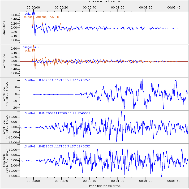
Earthquake location: Rat Islands, Aleutian Islands
Earthquake latitude/longitude: 51.1/178.6
Earthquake time(UTC): 2003/11/17 (321) 06:43:06 GMT
Earthquake Depth: 33 km
Earthquake Magnitude: 6.2 MB, 7.2 MS, 7.8 MW, 7.7 MW
Earthquake Catalog/Contributor: WHDF/NEIC
Network: US United States National Seismic Network
Station: WUAZ Wupatki, Arizona, USA
Lat/Lon: 35.52 N/111.37 W
Elevation: 1592 m
Distance: 51.3 deg
Az: 79.118 deg
Baz: 310.69 deg
Ray Param: 0.067436665
Estimated Moho Depth: 40.25 km
Estimated Crust Vp/Vs: 1.95
Assumed Crust Vp: 6.207 km/s
Estimated Crust Vs: 3.187 km/s
Estimated Crust Poisson's Ratio: 0.32
Radial Match: 94.683044 %
Radial Bump: 400
Transverse Match: 84.48814 %
Transverse Bump: 400
SOD ConfigId: 110177
Insert Time: 2010-03-05 04:49:51.026 +0000
GWidth: 2.5
Max Bumps: 400
Tol: 0.001

Signal To Noise

ChannelStoNSTALTA
US:WUAZ: :BHN:20031117T06:51:37.124005Z1.42129523.047604E-72.1442442E-7
US:WUAZ: :BHE:20031117T06:51:37.124005Z1.96820744.225777E-72.1470181E-7
US:WUAZ: :BHZ:20031117T06:51:37.124005Z2.9167395.887955E-72.0186773E-7
Arrivals
Ps6.4 SECOND
PpPs18 SECOND
PsPs/PpSs25 SECOND