WUAZ Wupatki, Arizona, USA - Earthquake Result Viewer
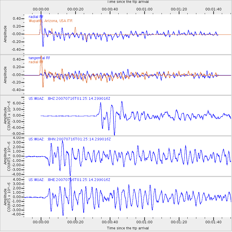
Earthquake location: Near West Coast Of Honshu, Japan
Earthquake latitude/longitude: 37.5/138.4
Earthquake time(UTC): 2007/07/16 (197) 01:13:22 GMT
Earthquake Depth: 12 km
Earthquake Magnitude: 6.5 MB, 6.4 MS, 6.6 MW, 6.5 MW
Earthquake Catalog/Contributor: WHDF/NEIC
Network: US United States National Seismic Network
Station: WUAZ Wupatki, Arizona, USA
Lat/Lon: 35.52 N/111.37 W
Elevation: 1592 m
Distance: 82.7 deg
Az: 50.531 deg
Baz: 311.214 deg
Ray Param: 0.046705455
Estimated Moho Depth: 19.75 km
Estimated Crust Vp/Vs: 1.80
Assumed Crust Vp: 6.207 km/s
Estimated Crust Vs: 3.448 km/s
Estimated Crust Poisson's Ratio: 0.28
Radial Match: 96.187584 %
Radial Bump: 400
Transverse Match: 91.36888 %
Transverse Bump: 400
SOD ConfigId: 2564
Insert Time: 2010-03-05 04:51:35.767 +0000
GWidth: 2.5
Max Bumps: 400
Tol: 0.001

Signal To Noise

ChannelStoNSTALTA
US:WUAZ: :BHN:20070716T01:25:14.299016Z4.22288375.889486E-71.3946597E-7
US:WUAZ: :BHE:20070716T01:25:14.299016Z6.6194365.532946E-78.358638E-8
US:WUAZ: :BHZ:20070716T01:25:14.299016Z42.675812.1446122E-65.0253576E-8
Arrivals
Ps2.6 SECOND
PpPs8.7 SECOND
PsPs/PpSs11 SECOND