You are here: Home > Network List > TA - USArray Transportable Network (new EarthScope stations) Stations List
> Station R11A Troy Canyon, Currant, NV, USA > Earthquake Result Viewer
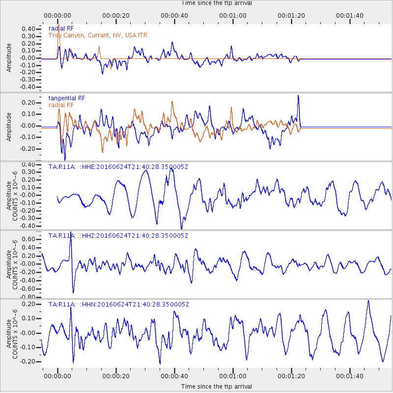
R11A Troy Canyon, Currant, NV, USA - Earthquake Result Viewer
*The percent match for this event was below the threshold and hence no stack was calculated.
| Earthquake location: |
Northern Chile |
| Earthquake latitude/longitude: |
-25.7/-69.3 |
| Earthquake time(UTC): |
2016/06/24 (176) 21:29:18 GMT |
| Earthquake Depth: |
122 km |
| Earthquake Magnitude: |
5.5 MB |
| Earthquake Catalog/Contributor: |
NEIC PDE/NEIC COMCAT |
|
| Network: |
TA USArray Transportable Network (new EarthScope stations) |
| Station: |
R11A Troy Canyon, Currant, NV, USA |
| Lat/Lon: |
38.35 N/115.59 W |
| Elevation: |
1756 m |
|
| Distance: |
77.1 deg |
| Az: |
324.364 deg |
| Baz: |
138.065 deg |
| Ray Param: |
$rayparam |
*The percent match for this event was below the threshold and hence was not used in the summary stack. |
|
| Radial Match: |
50.605053 % |
| Radial Bump: |
400 |
| Transverse Match: |
57.06268 % |
| Transverse Bump: |
400 |
| SOD ConfigId: |
7422571 |
| Insert Time: |
2019-04-22 22:09:24.639 +0000 |
| GWidth: |
2.5 |
| Max Bumps: |
400 |
| Tol: |
0.001 |
|
Signal To Noise
| Channel | StoN | STA | LTA |
| TA:R11A: :HHZ:20160624T21:40:28.350005Z | 1.8208659 | 2.3802404E-7 | 1.3072025E-7 |
| TA:R11A: :HHN:20160624T21:40:28.350005Z | 0.75188524 | 5.2753872E-8 | 7.016214E-8 |
| TA:R11A: :HHE:20160624T21:40:28.350005Z | 2.6082492 | 2.6057094E-7 | 9.990263E-8 |
| Arrivals |
| Ps | |
| PpPs | |
| PsPs/PpSs | |


