You are here: Home > Network List > G - GEOSCOPE Stations List
> Station MPG Montagne des Peres, French Guyana > Earthquake Result Viewer
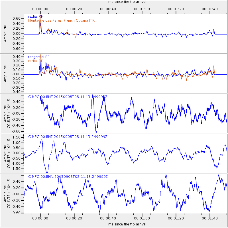
MPG Montagne des Peres, French Guyana - Earthquake Result Viewer
*The percent match for this event was below the threshold and hence no stack was calculated.
| Earthquake location: |
Near Coast Of Chiapas, Mexico |
| Earthquake latitude/longitude: |
14.7/-93.9 |
| Earthquake time(UTC): |
2015/09/08 (251) 08:03:54 GMT |
| Earthquake Depth: |
4.1 km |
| Earthquake Magnitude: |
5.5 MB, 5.7 MWB |
| Earthquake Catalog/Contributor: |
NEIC PDE/NEIC COMCAT |
|
| Network: |
G GEOSCOPE |
| Station: |
MPG Montagne des Peres, French Guyana |
| Lat/Lon: |
5.11 N/52.64 W |
| Elevation: |
147 m |
|
| Distance: |
41.7 deg |
| Az: |
98.9 deg |
| Baz: |
286.272 deg |
| Ray Param: |
$rayparam |
*The percent match for this event was below the threshold and hence was not used in the summary stack. |
|
| Radial Match: |
67.85004 % |
| Radial Bump: |
400 |
| Transverse Match: |
78.02681 % |
| Transverse Bump: |
400 |
| SOD ConfigId: |
1156111 |
| Insert Time: |
2015-09-22 08:22:01.728 +0000 |
| GWidth: |
2.5 |
| Max Bumps: |
400 |
| Tol: |
0.001 |
|
Signal To Noise
| Channel | StoN | STA | LTA |
| G:MPG:00:BHZ:20150908T08:11:13.249999Z | 5.572266 | 1.2309583E-6 | 2.2090803E-7 |
| G:MPG:00:BHN:20150908T08:11:13.249999Z | 1.079603 | 2.4390945E-7 | 2.2592513E-7 |
| G:MPG:00:BHE:20150908T08:11:13.249999Z | 1.7248443 | 4.0018477E-7 | 2.3201213E-7 |
| Arrivals |
| Ps | |
| PpPs | |
| PsPs/PpSs | |


