You are here: Home > Network List > CI - Caltech Regional Seismic Network Stations List
> Station SHO Shoshone, CA, USA > Earthquake Result Viewer
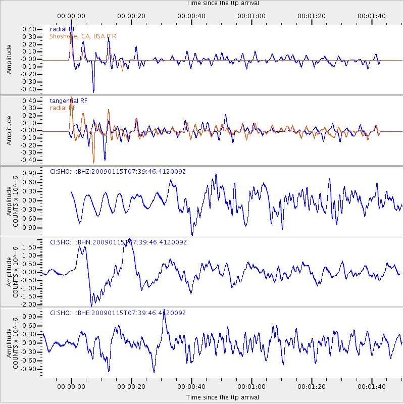
SHO Shoshone, CA, USA - Earthquake Result Viewer
*The percent match for this event was below the threshold and hence no stack was calculated.
| Earthquake location: |
Southeast Of Loyalty Islands |
| Earthquake latitude/longitude: |
-22.4/170.6 |
| Earthquake time(UTC): |
2009/01/15 (015) 07:27:20 GMT |
| Earthquake Depth: |
27 km |
| Earthquake Magnitude: |
5.8 MB, 6.5 MS, 6.7 MW, 6.6 MW |
| Earthquake Catalog/Contributor: |
WHDF/NEIC |
|
| Network: |
CI Caltech Regional Seismic Network |
| Station: |
SHO Shoshone, CA, USA |
| Lat/Lon: |
35.90 N/116.28 W |
| Elevation: |
451 m |
|
| Distance: |
90.1 deg |
| Az: |
50.969 deg |
| Baz: |
242.342 deg |
| Ray Param: |
$rayparam |
*The percent match for this event was below the threshold and hence was not used in the summary stack. |
|
| Radial Match: |
74.08874 % |
| Radial Bump: |
400 |
| Transverse Match: |
63.257057 % |
| Transverse Bump: |
400 |
| SOD ConfigId: |
2834 |
| Insert Time: |
2010-02-26 00:31:23.678 +0000 |
| GWidth: |
2.5 |
| Max Bumps: |
400 |
| Tol: |
0.001 |
|
Signal To Noise
| Channel | StoN | STA | LTA |
| CI:SHO: :BHN:20090115T07:39:46.412009Z | 9.092379 | 9.865007E-7 | 1.0849753E-7 |
| CI:SHO: :BHE:20090115T07:39:46.412009Z | 1.1795642 | 2.0379366E-7 | 1.727703E-7 |
| CI:SHO: :BHZ:20090115T07:39:46.412009Z | 1.6596787 | 4.3110617E-7 | 2.597528E-7 |
| Arrivals |
| Ps | |
| PpPs | |
| PsPs/PpSs | |


