You are here: Home > Network List > TA - USArray Transportable Network (new EarthScope stations) Stations List
> Station A21K Barrow, AK, USA > Earthquake Result Viewer
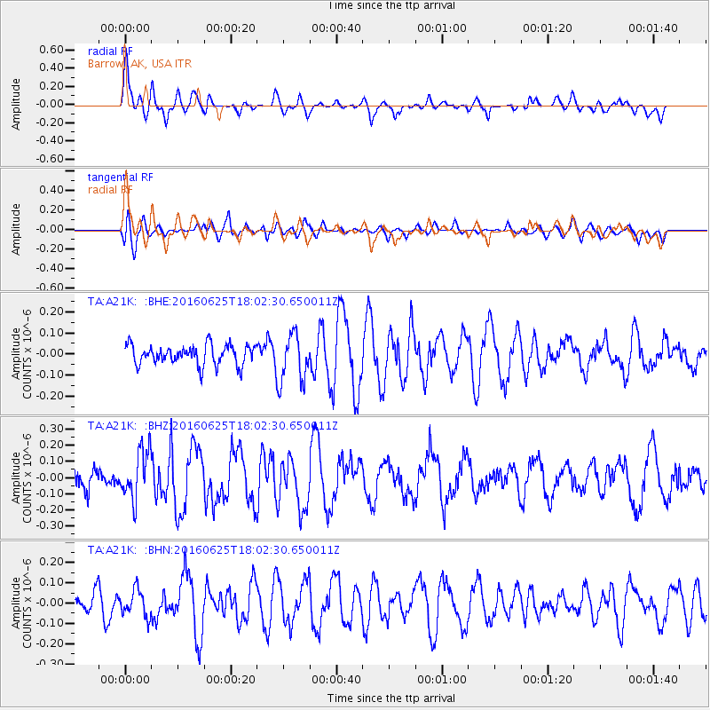
A21K Barrow, AK, USA - Earthquake Result Viewer
*The percent match for this event was below the threshold and hence no stack was calculated.
| Earthquake location: |
Reykjanes Ridge |
| Earthquake latitude/longitude: |
53.9/-35.4 |
| Earthquake time(UTC): |
2016/06/25 (177) 17:54:19 GMT |
| Earthquake Depth: |
10 km |
| Earthquake Magnitude: |
5.5 MWC, 5.5 MWC |
| Earthquake Catalog/Contributor: |
NEIC PDE/NEIC COMCAT |
|
| Network: |
TA USArray Transportable Network (new EarthScope stations) |
| Station: |
A21K Barrow, AK, USA |
| Lat/Lon: |
71.32 N/156.62 W |
| Elevation: |
577 m |
|
| Distance: |
48.4 deg |
| Az: |
338.383 deg |
| Baz: |
42.586 deg |
| Ray Param: |
$rayparam |
*The percent match for this event was below the threshold and hence was not used in the summary stack. |
|
| Radial Match: |
69.21367 % |
| Radial Bump: |
400 |
| Transverse Match: |
59.879093 % |
| Transverse Bump: |
400 |
| SOD ConfigId: |
11737051 |
| Insert Time: |
2019-04-24 23:39:40.899 +0000 |
| GWidth: |
2.5 |
| Max Bumps: |
400 |
| Tol: |
0.001 |
|
Signal To Noise
| Channel | StoN | STA | LTA |
| TA:A21K: :BHZ:20160625T18:02:30.650011Z | 2.684311 | 1.5235287E-7 | 5.675679E-8 |
| TA:A21K: :BHN:20160625T18:02:30.650011Z | 1.3119649 | 6.618164E-8 | 5.0444672E-8 |
| TA:A21K: :BHE:20160625T18:02:30.650011Z | 2.4092147 | 1.12997846E-7 | 4.6902358E-8 |
| Arrivals |
| Ps | |
| PpPs | |
| PsPs/PpSs | |


