You are here: Home > Network List > TA - USArray Transportable Network (new EarthScope stations) Stations List
> Station L20K Farewell, AK, USA > Earthquake Result Viewer
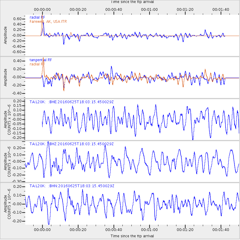
L20K Farewell, AK, USA - Earthquake Result Viewer
*The percent match for this event was below the threshold and hence no stack was calculated.
| Earthquake location: |
Reykjanes Ridge |
| Earthquake latitude/longitude: |
53.9/-35.4 |
| Earthquake time(UTC): |
2016/06/25 (177) 17:54:19 GMT |
| Earthquake Depth: |
10 km |
| Earthquake Magnitude: |
5.5 MWC, 5.5 MWC |
| Earthquake Catalog/Contributor: |
NEIC PDE/NEIC COMCAT |
|
| Network: |
TA USArray Transportable Network (new EarthScope stations) |
| Station: |
L20K Farewell, AK, USA |
| Lat/Lon: |
62.48 N/153.88 W |
| Elevation: |
673 m |
|
| Distance: |
54.4 deg |
| Az: |
329.857 deg |
| Baz: |
39.774 deg |
| Ray Param: |
$rayparam |
*The percent match for this event was below the threshold and hence was not used in the summary stack. |
|
| Radial Match: |
58.634163 % |
| Radial Bump: |
400 |
| Transverse Match: |
53.580997 % |
| Transverse Bump: |
400 |
| SOD ConfigId: |
11737051 |
| Insert Time: |
2019-04-24 23:39:54.225 +0000 |
| GWidth: |
2.5 |
| Max Bumps: |
400 |
| Tol: |
0.001 |
|
Signal To Noise
| Channel | StoN | STA | LTA |
| TA:L20K: :BHZ:20160625T18:03:15.450029Z | 1.848441 | 1.6321074E-7 | 8.8296424E-8 |
| TA:L20K: :BHN:20160625T18:03:15.450029Z | 1.3173705 | 1.0665936E-7 | 8.096383E-8 |
| TA:L20K: :BHE:20160625T18:03:15.450029Z | 0.96841073 | 6.638452E-8 | 6.8549966E-8 |
| Arrivals |
| Ps | |
| PpPs | |
| PsPs/PpSs | |


