You are here: Home > Network List > CI - Caltech Regional Seismic Network Stations List
> Station SHO Shoshone, CA, USA > Earthquake Result Viewer
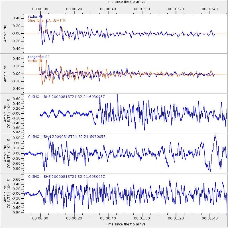
SHO Shoshone, CA, USA - Earthquake Result Viewer
*The percent match for this event was below the threshold and hence no stack was calculated.
| Earthquake location: |
South Of Fiji Islands |
| Earthquake latitude/longitude: |
-26.1/-178.4 |
| Earthquake time(UTC): |
2009/08/18 (230) 21:20:47 GMT |
| Earthquake Depth: |
270 km |
| Earthquake Magnitude: |
5.5 MB, 6.3 MW, 6.3 MW |
| Earthquake Catalog/Contributor: |
WHDF/NEIC |
|
| Network: |
CI Caltech Regional Seismic Network |
| Station: |
SHO Shoshone, CA, USA |
| Lat/Lon: |
35.90 N/116.28 W |
| Elevation: |
451 m |
|
| Distance: |
85.0 deg |
| Az: |
46.082 deg |
| Baz: |
232.941 deg |
| Ray Param: |
$rayparam |
*The percent match for this event was below the threshold and hence was not used in the summary stack. |
|
| Radial Match: |
76.93296 % |
| Radial Bump: |
400 |
| Transverse Match: |
61.74884 % |
| Transverse Bump: |
400 |
| SOD ConfigId: |
2622 |
| Insert Time: |
2010-02-26 00:31:27.189 +0000 |
| GWidth: |
2.5 |
| Max Bumps: |
400 |
| Tol: |
0.001 |
|
Signal To Noise
| Channel | StoN | STA | LTA |
| CI:SHO: :BHN:20090818T21:32:21.693005Z | 6.605281 | 4.3136257E-7 | 6.530571E-8 |
| CI:SHO: :BHE:20090818T21:32:21.693005Z | 2.8478947 | 1.9637254E-7 | 6.895358E-8 |
| CI:SHO: :BHZ:20090818T21:32:21.693005Z | 2.8061936 | 2.0892213E-7 | 7.445036E-8 |
| Arrivals |
| Ps | |
| PpPs | |
| PsPs/PpSs | |


