You are here: Home > Network List > CN - Canadian National Seismograph Network Stations List
> Station INK INUVIK, NT > Earthquake Result Viewer
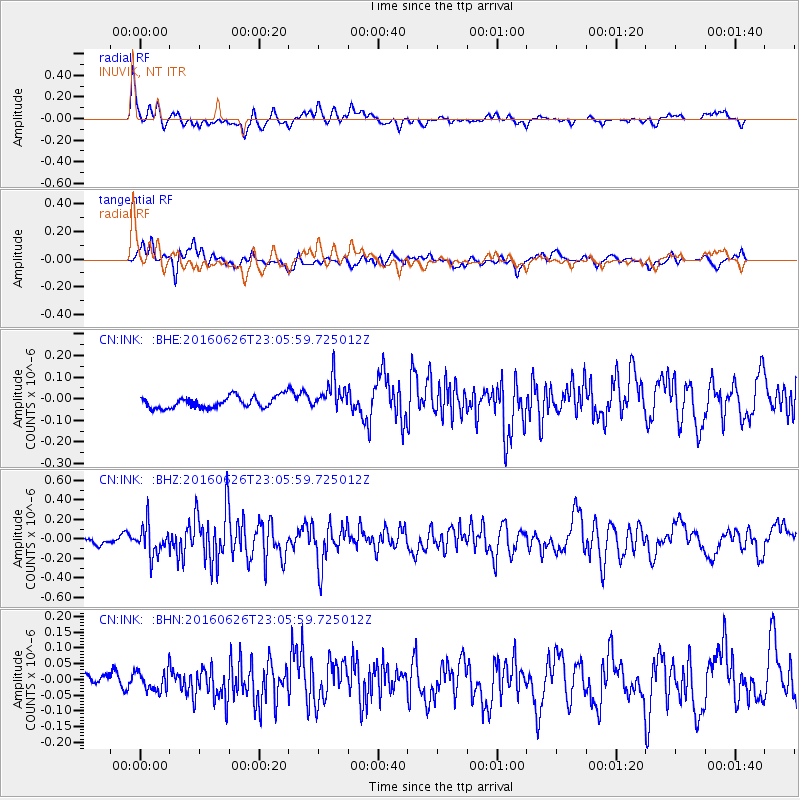
INK INUVIK, NT - Earthquake Result Viewer
*The percent match for this event was below the threshold and hence no stack was calculated.
| Earthquake location: |
Off East Coast Of Honshu, Japan |
| Earthquake latitude/longitude: |
37.0/142.1 |
| Earthquake time(UTC): |
2016/06/26 (178) 22:57:08 GMT |
| Earthquake Depth: |
19 km |
| Earthquake Magnitude: |
5.5 MWR |
| Earthquake Catalog/Contributor: |
NEIC PDE/NEIC COMCAT |
|
| Network: |
CN Canadian National Seismograph Network |
| Station: |
INK INUVIK, NT |
| Lat/Lon: |
68.31 N/133.53 W |
| Elevation: |
44 m |
|
| Distance: |
54.1 deg |
| Az: |
27.174 deg |
| Baz: |
280.643 deg |
| Ray Param: |
$rayparam |
*The percent match for this event was below the threshold and hence was not used in the summary stack. |
|
| Radial Match: |
73.2487 % |
| Radial Bump: |
400 |
| Transverse Match: |
68.54265 % |
| Transverse Bump: |
400 |
| SOD ConfigId: |
11737051 |
| Insert Time: |
2019-04-24 23:51:19.569 +0000 |
| GWidth: |
2.5 |
| Max Bumps: |
400 |
| Tol: |
0.001 |
|
Signal To Noise
| Channel | StoN | STA | LTA |
| CN:INK: :BHZ:20160626T23:05:59.725012Z | 3.0303435 | 1.5847347E-7 | 5.2295547E-8 |
| CN:INK: :BHN:20160626T23:05:59.725012Z | 1.1077327 | 3.3849137E-8 | 3.0557135E-8 |
| CN:INK: :BHE:20160626T23:05:59.725012Z | 2.530184 | 7.521573E-8 | 2.9727376E-8 |
| Arrivals |
| Ps | |
| PpPs | |
| PsPs/PpSs | |


