You are here: Home > Network List > TA - USArray Transportable Network (new EarthScope stations) Stations List
> Station A21K Barrow, AK, USA > Earthquake Result Viewer
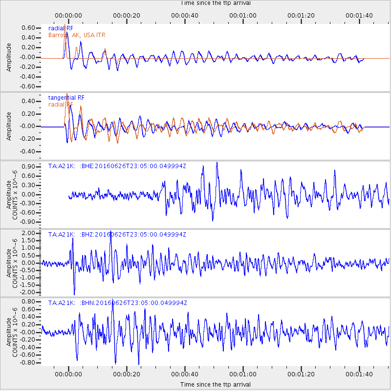
A21K Barrow, AK, USA - Earthquake Result Viewer
*The percent match for this event was below the threshold and hence no stack was calculated.
| Earthquake location: |
Off East Coast Of Honshu, Japan |
| Earthquake latitude/longitude: |
37.0/142.1 |
| Earthquake time(UTC): |
2016/06/26 (178) 22:57:08 GMT |
| Earthquake Depth: |
19 km |
| Earthquake Magnitude: |
5.5 MWR |
| Earthquake Catalog/Contributor: |
NEIC PDE/NEIC COMCAT |
|
| Network: |
TA USArray Transportable Network (new EarthScope stations) |
| Station: |
A21K Barrow, AK, USA |
| Lat/Lon: |
71.32 N/156.62 W |
| Elevation: |
577 m |
|
| Distance: |
46.2 deg |
| Az: |
23.029 deg |
| Baz: |
256.282 deg |
| Ray Param: |
$rayparam |
*The percent match for this event was below the threshold and hence was not used in the summary stack. |
|
| Radial Match: |
82.380554 % |
| Radial Bump: |
400 |
| Transverse Match: |
77.885765 % |
| Transverse Bump: |
400 |
| SOD ConfigId: |
11737051 |
| Insert Time: |
2019-04-24 23:55:29.179 +0000 |
| GWidth: |
2.5 |
| Max Bumps: |
400 |
| Tol: |
0.001 |
|
Signal To Noise
| Channel | StoN | STA | LTA |
| TA:A21K: :BHZ:20160626T23:05:00.049994Z | 6.645334 | 6.995762E-7 | 1.05273294E-7 |
| TA:A21K: :BHN:20160626T23:05:00.049994Z | 4.51736 | 2.7722916E-7 | 6.1369725E-8 |
| TA:A21K: :BHE:20160626T23:05:00.049994Z | 3.5032537 | 2.576458E-7 | 7.354472E-8 |
| Arrivals |
| Ps | |
| PpPs | |
| PsPs/PpSs | |


