You are here: Home > Network List > TA - USArray Transportable Network (new EarthScope stations) Stations List
> Station F21K Alatna River, AK, USA > Earthquake Result Viewer
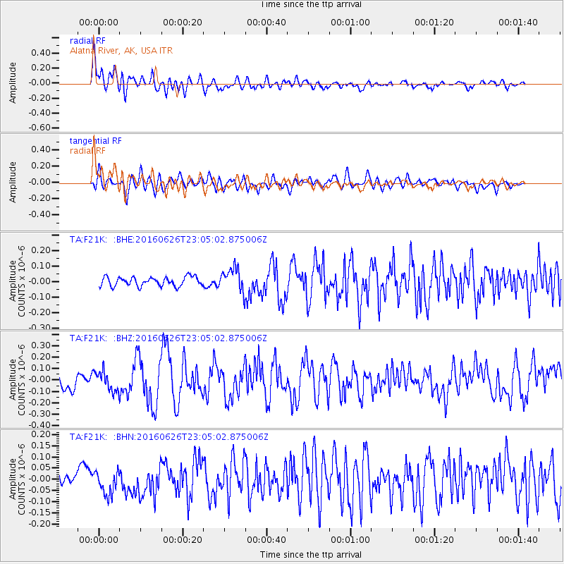
F21K Alatna River, AK, USA - Earthquake Result Viewer
*The percent match for this event was below the threshold and hence no stack was calculated.
| Earthquake location: |
Off East Coast Of Honshu, Japan |
| Earthquake latitude/longitude: |
37.0/142.1 |
| Earthquake time(UTC): |
2016/06/26 (178) 22:57:08 GMT |
| Earthquake Depth: |
19 km |
| Earthquake Magnitude: |
5.5 MWR |
| Earthquake Catalog/Contributor: |
NEIC PDE/NEIC COMCAT |
|
| Network: |
TA USArray Transportable Network (new EarthScope stations) |
| Station: |
F21K Alatna River, AK, USA |
| Lat/Lon: |
67.22 N/153.48 W |
| Elevation: |
597 m |
|
| Distance: |
46.6 deg |
| Az: |
28.902 deg |
| Baz: |
263.265 deg |
| Ray Param: |
$rayparam |
*The percent match for this event was below the threshold and hence was not used in the summary stack. |
|
| Radial Match: |
73.93163 % |
| Radial Bump: |
400 |
| Transverse Match: |
64.087585 % |
| Transverse Bump: |
400 |
| SOD ConfigId: |
11737051 |
| Insert Time: |
2019-04-24 23:55:35.749 +0000 |
| GWidth: |
2.5 |
| Max Bumps: |
400 |
| Tol: |
0.001 |
|
Signal To Noise
| Channel | StoN | STA | LTA |
| TA:F21K: :BHZ:20160626T23:05:02.875006Z | 1.5230051 | 8.7136534E-8 | 5.7213555E-8 |
| TA:F21K: :BHN:20160626T23:05:02.875006Z | 1.5953891 | 5.6903858E-8 | 3.56677E-8 |
| TA:F21K: :BHE:20160626T23:05:02.875006Z | 3.0773442 | 9.211523E-8 | 2.9933354E-8 |
| Arrivals |
| Ps | |
| PpPs | |
| PsPs/PpSs | |


