You are here: Home > Network List > TA - USArray Transportable Network (new EarthScope stations) Stations List
> Station J20K Nowitna River, AK, USA > Earthquake Result Viewer
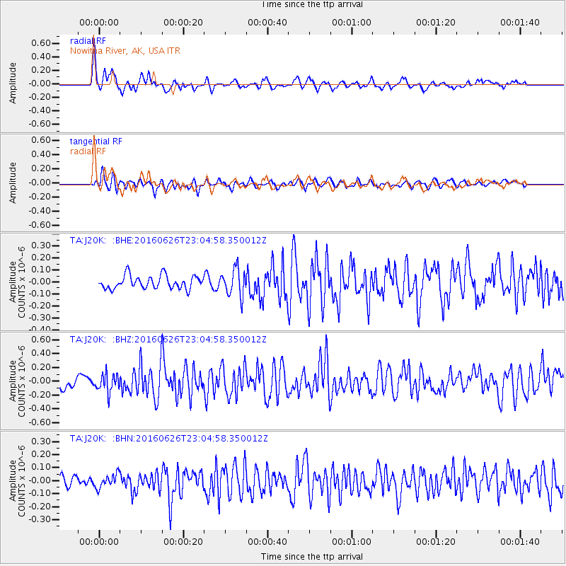
J20K Nowitna River, AK, USA - Earthquake Result Viewer
*The percent match for this event was below the threshold and hence no stack was calculated.
| Earthquake location: |
Off East Coast Of Honshu, Japan |
| Earthquake latitude/longitude: |
37.0/142.1 |
| Earthquake time(UTC): |
2016/06/26 (178) 22:57:08 GMT |
| Earthquake Depth: |
19 km |
| Earthquake Magnitude: |
5.5 MWR |
| Earthquake Catalog/Contributor: |
NEIC PDE/NEIC COMCAT |
|
| Network: |
TA USArray Transportable Network (new EarthScope stations) |
| Station: |
J20K Nowitna River, AK, USA |
| Lat/Lon: |
64.18 N/154.15 W |
| Elevation: |
314 m |
|
| Distance: |
46.0 deg |
| Az: |
33.076 deg |
| Baz: |
265.545 deg |
| Ray Param: |
$rayparam |
*The percent match for this event was below the threshold and hence was not used in the summary stack. |
|
| Radial Match: |
78.45956 % |
| Radial Bump: |
400 |
| Transverse Match: |
71.194695 % |
| Transverse Bump: |
400 |
| SOD ConfigId: |
11737051 |
| Insert Time: |
2019-04-24 23:55:42.874 +0000 |
| GWidth: |
2.5 |
| Max Bumps: |
400 |
| Tol: |
0.001 |
|
Signal To Noise
| Channel | StoN | STA | LTA |
| TA:J20K: :BHZ:20160626T23:04:58.350012Z | 1.8684072 | 1.3017417E-7 | 6.96712E-8 |
| TA:J20K: :BHN:20160626T23:04:58.350012Z | 0.96794933 | 5.3413608E-8 | 5.5182237E-8 |
| TA:J20K: :BHE:20160626T23:04:58.350012Z | 2.1559641 | 1.2347098E-7 | 5.7269503E-8 |
| Arrivals |
| Ps | |
| PpPs | |
| PsPs/PpSs | |


