You are here: Home > Network List > US - United States National Seismic Network Stations List
> Station WUAZ Wupatki, Arizona, USA > Earthquake Result Viewer
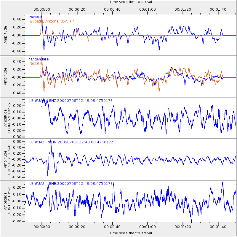
WUAZ Wupatki, Arizona, USA - Earthquake Result Viewer
*The percent match for this event was below the threshold and hence no stack was calculated.
| Earthquake location: |
Southeast Of Ryukyu Islands |
| Earthquake latitude/longitude: |
24.9/128.0 |
| Earthquake time(UTC): |
2009/07/06 (187) 22:35:05 GMT |
| Earthquake Depth: |
10 km |
| Earthquake Magnitude: |
6.1 MB, 5.3 MS, 5.7 MW, 5.7 MW |
| Earthquake Catalog/Contributor: |
WHDF/NEIC |
|
| Network: |
US United States National Seismic Network |
| Station: |
WUAZ Wupatki, Arizona, USA |
| Lat/Lon: |
35.52 N/111.37 W |
| Elevation: |
1592 m |
|
| Distance: |
97.8 deg |
| Az: |
45.129 deg |
| Baz: |
307.901 deg |
| Ray Param: |
$rayparam |
*The percent match for this event was below the threshold and hence was not used in the summary stack. |
|
| Radial Match: |
61.13989 % |
| Radial Bump: |
400 |
| Transverse Match: |
42.426876 % |
| Transverse Bump: |
400 |
| SOD ConfigId: |
2648 |
| Insert Time: |
2010-03-05 04:56:40.042 +0000 |
| GWidth: |
2.5 |
| Max Bumps: |
400 |
| Tol: |
0.001 |
|
Signal To Noise
| Channel | StoN | STA | LTA |
| US:WUAZ: :BHN:20090706T22:48:08.475017Z | 3.2216592 | 2.1122915E-7 | 6.556533E-8 |
| US:WUAZ: :BHE:20090706T22:48:08.475017Z | 1.792391 | 1.0568063E-7 | 5.89607E-8 |
| US:WUAZ: :BHZ:20090706T22:48:08.475017Z | 0.75494486 | 1.0547046E-7 | 1.3970617E-7 |
| Arrivals |
| Ps | |
| PpPs | |
| PsPs/PpSs | |


