You are here: Home > Network List > US - United States National Seismic Network Stations List
> Station WUAZ Wupatki, Arizona, USA > Earthquake Result Viewer
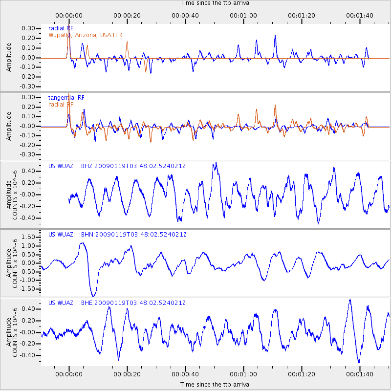
WUAZ Wupatki, Arizona, USA - Earthquake Result Viewer
*The percent match for this event was below the threshold and hence no stack was calculated.
| Earthquake location: |
Southeast Of Loyalty Islands |
| Earthquake latitude/longitude: |
-22.6/170.9 |
| Earthquake time(UTC): |
2009/01/19 (019) 03:35:18 GMT |
| Earthquake Depth: |
12 km |
| Earthquake Magnitude: |
5.7 MB, 6.4 MS, 6.5 MW, 6.5 MW |
| Earthquake Catalog/Contributor: |
WHDF/NEIC |
|
| Network: |
US United States National Seismic Network |
| Station: |
WUAZ Wupatki, Arizona, USA |
| Lat/Lon: |
35.52 N/111.37 W |
| Elevation: |
1592 m |
|
| Distance: |
93.5 deg |
| Az: |
52.994 deg |
| Baz: |
244.776 deg |
| Ray Param: |
$rayparam |
*The percent match for this event was below the threshold and hence was not used in the summary stack. |
|
| Radial Match: |
63.687756 % |
| Radial Bump: |
400 |
| Transverse Match: |
76.05259 % |
| Transverse Bump: |
400 |
| SOD ConfigId: |
2658 |
| Insert Time: |
2010-03-05 04:56:46.441 +0000 |
| GWidth: |
2.5 |
| Max Bumps: |
400 |
| Tol: |
0.001 |
|
Signal To Noise
| Channel | StoN | STA | LTA |
| US:WUAZ: :BHN:20090119T03:48:02.524021Z | 3.888199 | 6.2008365E-7 | 1.5947838E-7 |
| US:WUAZ: :BHE:20090119T03:48:02.524021Z | 0.42100078 | 5.477976E-8 | 1.3011795E-7 |
| US:WUAZ: :BHZ:20090119T03:48:02.524021Z | 1.154097 | 2.0115027E-7 | 1.7429235E-7 |
| Arrivals |
| Ps | |
| PpPs | |
| PsPs/PpSs | |


