You are here: Home > Network List > CI - Caltech Regional Seismic Network Stations List
> Station SHO Shoshone, CA, USA > Earthquake Result Viewer
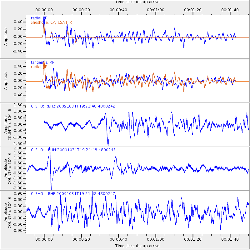
SHO Shoshone, CA, USA - Earthquake Result Viewer
*The percent match for this event was below the threshold and hence no stack was calculated.
| Earthquake location: |
Santa Cruz Islands |
| Earthquake latitude/longitude: |
-11.4/166.4 |
| Earthquake time(UTC): |
2009/10/31 (304) 19:09:51 GMT |
| Earthquake Depth: |
134 km |
| Earthquake Magnitude: |
5.9 MB, 5.9 MW, 5.9 MW |
| Earthquake Catalog/Contributor: |
WHDF/NEIC |
|
| Network: |
CI Caltech Regional Seismic Network |
| Station: |
SHO Shoshone, CA, USA |
| Lat/Lon: |
35.90 N/116.28 W |
| Elevation: |
451 m |
|
| Distance: |
86.6 deg |
| Az: |
52.526 deg |
| Baz: |
253.441 deg |
| Ray Param: |
$rayparam |
*The percent match for this event was below the threshold and hence was not used in the summary stack. |
|
| Radial Match: |
78.867744 % |
| Radial Bump: |
400 |
| Transverse Match: |
66.298035 % |
| Transverse Bump: |
400 |
| SOD ConfigId: |
2622 |
| Insert Time: |
2010-02-26 00:31:44.232 +0000 |
| GWidth: |
2.5 |
| Max Bumps: |
400 |
| Tol: |
0.001 |
|
Signal To Noise
| Channel | StoN | STA | LTA |
| CI:SHO: :BHN:20091031T19:21:48.480024Z | 5.3316345 | 9.984374E-7 | 1.8726665E-7 |
| CI:SHO: :BHE:20091031T19:21:48.480024Z | 1.7176872 | 2.619445E-7 | 1.5249837E-7 |
| CI:SHO: :BHZ:20091031T19:21:48.480024Z | 4.083708 | 6.9119267E-7 | 1.6925615E-7 |
| Arrivals |
| Ps | |
| PpPs | |
| PsPs/PpSs | |


