You are here: Home > Network List > CN - Canadian National Seismograph Network Stations List
> Station INK INUVIK, NT > Earthquake Result Viewer
INK INUVIK, NT - Earthquake Result Viewer
*The percent match for this event was below the threshold and hence no stack was calculated.
| Earthquake location: |
Tajikistan-Xinjiang Border Reg. |
| Earthquake latitude/longitude: |
39.5/73.3 |
| Earthquake time(UTC): |
2016/06/28 (180) 21:38:04 GMT |
| Earthquake Depth: |
14 km |
| Earthquake Magnitude: |
5.5 MWW, 5.4 MWB, 5.5 MWC |
| Earthquake Catalog/Contributor: |
NEIC PDE/NEIC COMCAT |
|
| Network: |
CN Canadian National Seismograph Network |
| Station: |
INK INUVIK, NT |
| Lat/Lon: |
68.31 N/133.53 W |
| Elevation: |
44 m |
|
| Distance: |
70.7 deg |
| Az: |
10.254 deg |
| Baz: |
338.247 deg |
| Ray Param: |
$rayparam |
*The percent match for this event was below the threshold and hence was not used in the summary stack. |
|
| Radial Match: |
74.729294 % |
| Radial Bump: |
400 |
| Transverse Match: |
61.844448 % |
| Transverse Bump: |
400 |
| SOD ConfigId: |
11737051 |
| Insert Time: |
2019-04-25 00:07:51.470 +0000 |
| GWidth: |
2.5 |
| Max Bumps: |
400 |
| Tol: |
0.001 |
|
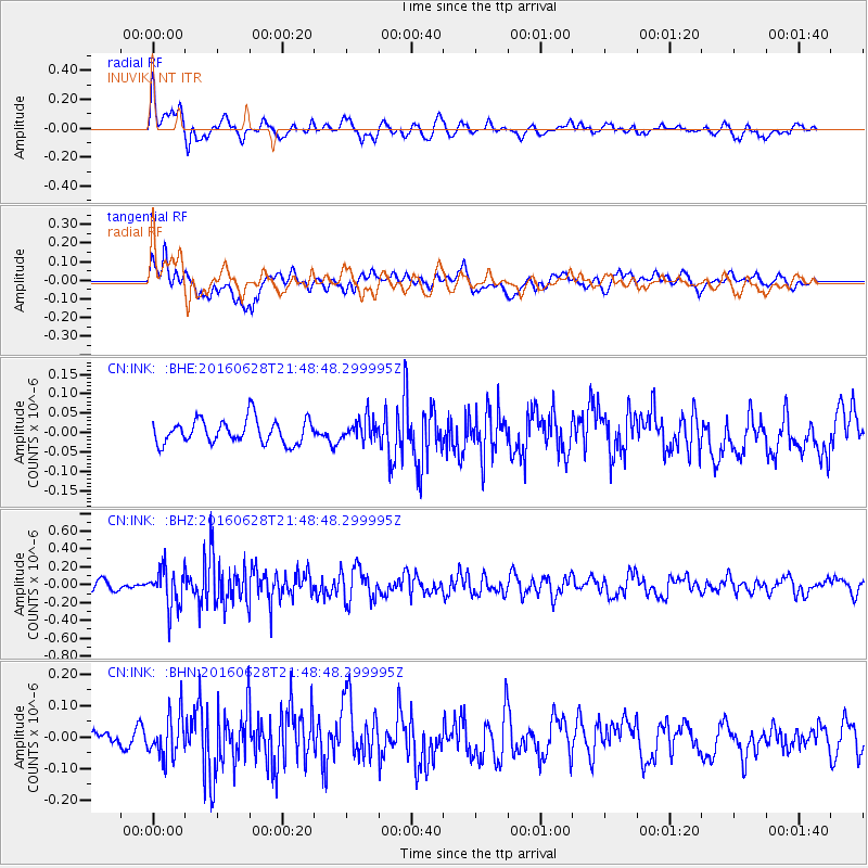
Signal To Noise
| Channel | StoN | STA | LTA |
| CN:INK: :BHZ:20160628T21:48:48.299995Z | 3.7856507 | 2.1468082E-7 | 5.6709094E-8 |
| CN:INK: :BHN:20160628T21:48:48.299995Z | 2.7474172 | 6.799953E-8 | 2.4750348E-8 |
| CN:INK: :BHE:20160628T21:48:48.299995Z | 0.92826086 | 2.8680684E-8 | 3.0897223E-8 |
| Arrivals |
| Ps | |
| PpPs | |
| PsPs/PpSs | |


