You are here: Home > Network List > TA - USArray Transportable Network (new EarthScope stations) Stations List
> Station D23K Nanushuk River, AK USA > Earthquake Result Viewer
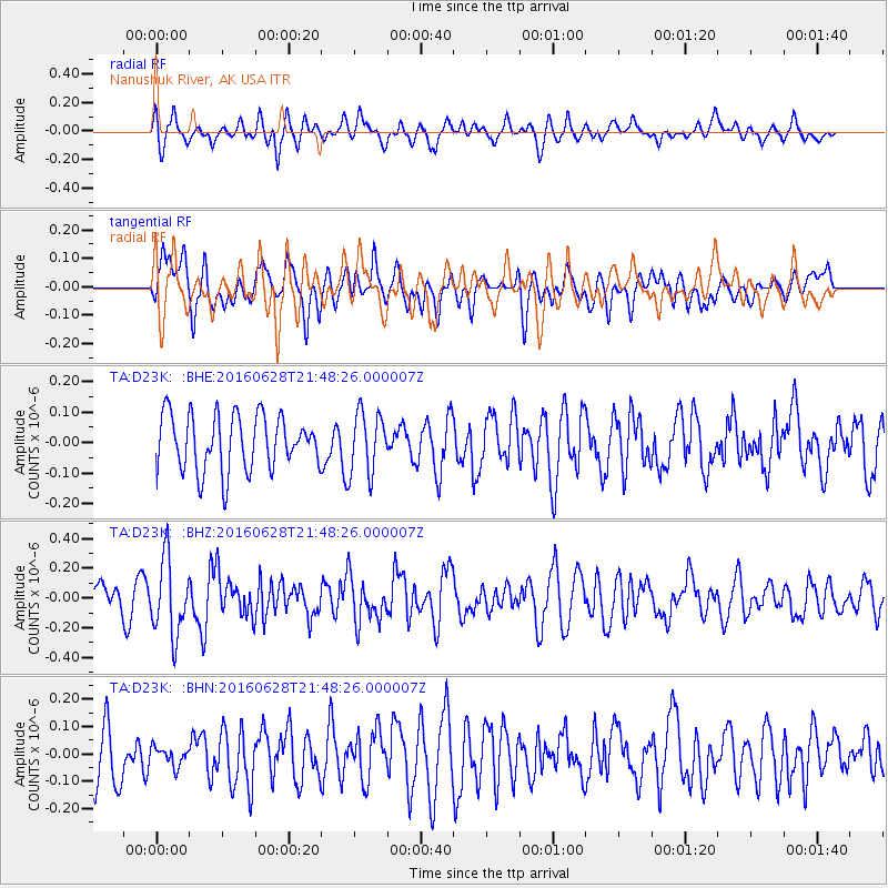
D23K Nanushuk River, AK USA - Earthquake Result Viewer
*The percent match for this event was below the threshold and hence no stack was calculated.
| Earthquake location: |
Tajikistan-Xinjiang Border Reg. |
| Earthquake latitude/longitude: |
39.5/73.3 |
| Earthquake time(UTC): |
2016/06/28 (180) 21:38:04 GMT |
| Earthquake Depth: |
14 km |
| Earthquake Magnitude: |
5.5 MWW, 5.4 MWB, 5.5 MWC |
| Earthquake Catalog/Contributor: |
NEIC PDE/NEIC COMCAT |
|
| Network: |
TA USArray Transportable Network (new EarthScope stations) |
| Station: |
D23K Nanushuk River, AK USA |
| Lat/Lon: |
68.97 N/150.68 W |
| Elevation: |
406 m |
|
| Distance: |
67.1 deg |
| Az: |
15.806 deg |
| Baz: |
324.272 deg |
| Ray Param: |
$rayparam |
*The percent match for this event was below the threshold and hence was not used in the summary stack. |
|
| Radial Match: |
56.31012 % |
| Radial Bump: |
400 |
| Transverse Match: |
56.348244 % |
| Transverse Bump: |
400 |
| SOD ConfigId: |
11737051 |
| Insert Time: |
2019-04-25 00:10:20.170 +0000 |
| GWidth: |
2.5 |
| Max Bumps: |
400 |
| Tol: |
0.001 |
|
Signal To Noise
| Channel | StoN | STA | LTA |
| TA:D23K: :BHZ:20160628T21:48:26.000007Z | 2.3182476 | 2.5253837E-7 | 1.08935026E-7 |
| TA:D23K: :BHN:20160628T21:48:26.000007Z | 0.33158085 | 3.3851066E-8 | 1.02089935E-7 |
| TA:D23K: :BHE:20160628T21:48:26.000007Z | 1.0947111 | 9.9005426E-8 | 9.043978E-8 |
| Arrivals |
| Ps | |
| PpPs | |
| PsPs/PpSs | |


