You are here: Home > Network List > TA - USArray Transportable Network (new EarthScope stations) Stations List
> Station R17K Ugashik Creek, AK, USA > Earthquake Result Viewer
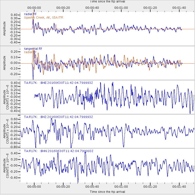
R17K Ugashik Creek, AK, USA - Earthquake Result Viewer
*The percent match for this event was below the threshold and hence no stack was calculated.
| Earthquake location: |
Vanuatu Islands |
| Earthquake latitude/longitude: |
-16.1/167.4 |
| Earthquake time(UTC): |
2016/06/30 (182) 11:30:34 GMT |
| Earthquake Depth: |
40 km |
| Earthquake Magnitude: |
5.8 MB |
| Earthquake Catalog/Contributor: |
NEIC PDE/NEIC COMCAT |
|
| Network: |
TA USArray Transportable Network (new EarthScope stations) |
| Station: |
R17K Ugashik Creek, AK, USA |
| Lat/Lon: |
57.64 N/156.39 W |
| Elevation: |
273 m |
|
| Distance: |
79.3 deg |
| Az: |
18.853 deg |
| Baz: |
215.283 deg |
| Ray Param: |
$rayparam |
*The percent match for this event was below the threshold and hence was not used in the summary stack. |
|
| Radial Match: |
63.15193 % |
| Radial Bump: |
400 |
| Transverse Match: |
50.65043 % |
| Transverse Bump: |
400 |
| SOD ConfigId: |
11737051 |
| Insert Time: |
2019-04-25 00:23:51.044 +0000 |
| GWidth: |
2.5 |
| Max Bumps: |
400 |
| Tol: |
0.001 |
|
Signal To Noise
| Channel | StoN | STA | LTA |
| TA:R17K: :BHZ:20160630T11:42:04.799993Z | 2.744086 | 3.6296342E-7 | 1.3227115E-7 |
| TA:R17K: :BHN:20160630T11:42:04.799993Z | 1.7960699 | 1.8885883E-7 | 1.0515116E-7 |
| TA:R17K: :BHE:20160630T11:42:04.799993Z | 1.0770196 | 1.342768E-7 | 1.2467443E-7 |
| Arrivals |
| Ps | |
| PpPs | |
| PsPs/PpSs | |


