You are here: Home > Network List > G - GEOSCOPE Stations List
> Station INU Inuyama, Japan > Earthquake Result Viewer
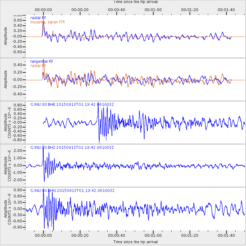
INU Inuyama, Japan - Earthquake Result Viewer
*The percent match for this event was below the threshold and hence no stack was calculated.
| Earthquake location: |
Minahassa Peninsula, Sulawesi |
| Earthquake latitude/longitude: |
0.1/123.4 |
| Earthquake time(UTC): |
2015/09/13 (256) 01:13:12 GMT |
| Earthquake Depth: |
123 km |
| Earthquake Magnitude: |
5.8 MB |
| Earthquake Catalog/Contributor: |
NEIC PDE/NEIC COMCAT |
|
| Network: |
G GEOSCOPE |
| Station: |
INU Inuyama, Japan |
| Lat/Lon: |
35.35 N/137.03 E |
| Elevation: |
132 m |
|
| Distance: |
37.3 deg |
| Az: |
18.535 deg |
| Baz: |
202.884 deg |
| Ray Param: |
$rayparam |
*The percent match for this event was below the threshold and hence was not used in the summary stack. |
|
| Radial Match: |
73.31242 % |
| Radial Bump: |
400 |
| Transverse Match: |
67.49687 % |
| Transverse Bump: |
400 |
| SOD ConfigId: |
1156111 |
| Insert Time: |
2015-09-27 01:21:35.263 +0000 |
| GWidth: |
2.5 |
| Max Bumps: |
400 |
| Tol: |
0.001 |
|
Signal To Noise
| Channel | StoN | STA | LTA |
| G:INU:00:BHZ:20150913T01:19:42.061003Z | 7.8052783 | 1.0189333E-6 | 1.3054414E-7 |
| G:INU:00:BHN:20150913T01:19:42.061003Z | 5.3278737 | 5.0463274E-7 | 9.4715595E-8 |
| G:INU:00:BHE:20150913T01:19:42.061003Z | 4.461227 | 4.480829E-7 | 1.0043939E-7 |
| Arrivals |
| Ps | |
| PpPs | |
| PsPs/PpSs | |


